Other ID: 85G-07-3
Status: Completed
Organization(s): USGS, Woods Hole Coastal and Marine Science Center
Funding Program(s):
Principal Investigator(s): Bradford Butman
Affiliate Investigator(s):
Information Specialist(s):
Data Type(s): Environmental Data: Temperature, Sonar: Single Beam, Time Series: Mooring (physical oceanography)
Scientific Purpose/Goals: Deploy a single-current meter mooring (#301) in Rodgers Pass, in the sill between Georges Basin and Wilkinson Basin. The mooring will monitor the seasonal flow of slope water between these two basins and will complement measurements by D. Brooks (TAMU) in Wilkinson Basin.
Vehicle(s):
Start Port/Location: Boothbay Harbor, ME
End Port/Location: Woods Hole, MA
Start Date: 1985-07-24
End Date: 1985-07-26
Equipment Used: XBT, 12 kHz, Bottom platform
Information to be Derived: Time series data; Bathymetric maps;
Summary of Activity and Data Gathered: XBT Stations: 20; Mooring deployed: 1 (#301 recovered FA 86011 EDWIN LINK Jul. 20 - Aug. 1, 1986, with FA 86012 MARY LOUISE Jul. 20-22, 1986).
Staff: Michael Bothner, Bradford Butman, Gregory DiLisio, John Larson, John Moody, Carol M. Parmenter
Affiliate Staff:
Notes:
Location:
Rodgers Pass, Gulf of Maine, United States, North America, North Atlantic;
| Boundaries | |||
|---|---|---|---|
| North: 42.66667 | South: 42.31667 | West: -68.8333 | East: -68.51667 |
Platform(s):
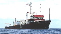
 Gyre |
| Title | Survey Equipment | Description |
|---|---|---|
| Cruise report | (document not focused on specific equipment) | Chief Scientist's report of ship movement, personnel, equipment, XBT station locations, and trackmap with mooring location. |
| Survey Equipment | Survey Info | Data Type(s) | Data Collected |
|---|---|---|---|
| XBT | --- | Temperature | |
| 12 kHz | --- | Single Beam | 1985-024-FA-SE-001 ( Collection of paper record displays of seismic data( 12K) for lines ) |
| Bottom platform | --- | Mooring (physical oceanography) | 1985-024-FA-OM-001 (Gulf of Maine mooring data) |