Other ID: none
Status: Completed
Organization(s): USGS, Woods Hole Coastal and Marine Science Center
Funding Program(s):
Principal Investigator(s): William J. Strahle
Affiliate Investigator(s):
Information Specialist(s):
Data Type(s): Imagery: Photo, Time Series: Mooring (physical oceanography)
Scientific Purpose/Goals: Deploy mooring #305 at Site B and moorings 306 and 307 at Site E, Cape Cod Bay.
Vehicle(s):
Start Port/Location: Woods Hole, MA
End Port/Location: Woods Hole, MA
Start Date: 1986-02-10
End Date: 1986-02-14
Equipment Used: Bottom platform, Camera- deep sea
Information to be Derived: Time series data;
Summary of Activity and Data Gathered: Moorings deployed: 3 (#305, 306, and 307, all recovered FA 86005 ASTERIAS Apr. 28-30, 1986).
Staff: John Larson, Joseph S. Newell, William J. Strahle
Affiliate Staff:
Val Wilson - WHOI
Notes: No cruise report; information derived from mooring log. Leg 1: Feb. 10, 1986. Leg 2: Feb. 14, 1986.
Location:
Cape Cod Bay, Massachusetts, United States, North America, North Atlantic,
| Boundaries | |||
|---|---|---|---|
| North: 42.25 | South: 41.5 | West: -70.75 | East: -70 |
Platform(s):
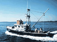
 Asterias |
Warner, J.C., Butman, B., and Dalyander, P. S., 2008, Storm-driven sediment transport in Massachusetts Bay: Continental Shelf Research, v. 28 no. 2, doi: 10.1016/j.csr.2007.08.008.
Warner, J.C., Sherwood, Christopher R., Signell, Richard P., Harris, Courtney K., and Arango, Hernan G., 2008, Development of a three-dimensional, regional, coupled wave, current, and sediment-transport model: Computers and Geosciences, v. 34 no. 10, doi: 10.1016/j.cageo.2008.02.012.
| Survey Equipment | Survey Info | Data Type(s) | Data Collected |
|---|---|---|---|
| Bottom platform | --- | Mooring (physical oceanography) | 1986-034-FA-OM-001 (Cape Cod Bay mooring data) |
| Camera- deep sea | --- | Photo | 1986-034-FA-PH-001 (film collection of TRIPOD 306; 19860210-19860429) |