Other ID: F-13-88-NC,88020
Status: Completed
Organization(s): USGS, Pacific Coastal and Marine Science Center, USGS, Woods Hole Coastal and Marine Science Center
Funding Program(s):
Principal Investigator(s): Bradford Butman, Dave Cacchione, Dave Drake
Affiliate Investigator(s): Dave Cacchione and Dave Drake, USGS-Menlo Park
Information Specialist(s):
Data Type(s): Sampling: Chemistry, Sampling: Geology, Environmental Data: CTD, Sampling: Biology, Imagery: Photo, Visual Identification: Ground Truthing, Location-Elevation: Navigation, Sonar: Sidescan, Time Series: Mooring (physical oceanography), Environmental Data: Current, Seismics: Sub Bottom Profiler
Scientific Purpose/Goals: This cruise was conducted as a part of the sediment transport component of the MMS California OCS Phase II Monitoring Program. Data were successfully collected during the spring/summer of 1987. This cruise was designed to obtain data during the winter season. The specific objectives were: 1. conduct a sidescan survey at project sites R8, PJ1, and R9; 2. deploy 2 surface guard buoys at each site (R8, PJ1, and R9); 3. deploy 3 subsurface current meter moorings at R8, PJ1, and R9; 4. deploy 2 GEOPROBE tripods at R8 and PJ1; 5. collect box cores for detailed sediment analyses; and 6. collect hydrographic and suspended matter samples.
Vehicle(s):
Start Port/Location: Redwood City, CA and Redwood City, CA and Santa Cruz, CA and San Luis Obispo, CA
End Port/Location: Redwood City, CA and Santa Cruz, CA and San Luis Obispo, CA and Redwood City, CA
Start Date: 1988-12-05
End Date: 1988-12-13
Equipment Used: GEOPROBE, SBE 9 CTD, Sidescan sonar, Gravity corer, Box corer, Camera- deep sea, Mooring tripod, GPS (wh), Loran-C, rangerange, GPS, integratednavigation, RhoRho, sidescansonar, guardbuoy, boxcore, gravitycore, currentmeter, Geoprobe, CTD, 3.5khz, underwatercamera, vectoravg, instrumentmooring
Information to be Derived: Time series data; Samples and chemical analysis; Grain size analysis; Suspended sediment concentrations; Sea floor map;
Summary of Activity and Data Gathered: Moorings deployed: 6 (#327, 328, 329, 330, 331, and 332, recovered FA 89004 FARNELLA Feb. 21-28, 1989). CTD stations: 13; Sidescan sonar: 48 km; Box cores: 6 (processed shipboard by WHOI for E. Crycelius, Battelle); Gravity core: 1; Water samples: 33.
Staff: Bradford Butman, Richard Rendigs, William J. Strahle
Affiliate Staff:
USGS Menlo Park: David Cacchione
David Drake
Jim Nicholson
George Tate
Rick Vail
Kevin O'Toole
Corky Ozanne
Kaye Kinoshita
Barbara Seekins
John Gann
and Lida Beth Pickthorn; WHOI: Rosemarie Petrecca and Charlotte Fuller; ONR: Kevin Briggs
Rick Ray; and Giovanni Bortoluzzi (visiting scientist)
Notes: Sediment Transport in Storms (STRESS). SAMPLING PT. SAL, From USGS Eastern Region admincru database... Control # --- 362 PlatformDate ID --- FRNL19881207 Sea Days --- 7 Scientists --- 19 Scientific Days --- 133 WHFC Persons --- 14 WHFC Person Days --- 98 Study Region... Northern East Coast --- N Middle East Coast --- N Southern East Coast --- N Puerto Rico --- N Gulf Coast --- N Virgin Islands --- N
Staff information imported from InfoBank
Dave Cacchione (USGS Western Region) - Chief Scientist
Dave Drake (USGS Western Region) - Chief Scientist
Location:
California
| Boundaries | |||
|---|---|---|---|
| North: 38.68461 | South: 34.85722 | West: -123.5291 | East: -120.71398 |
Platform(s):
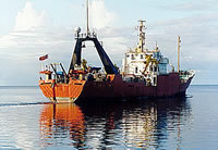
 Farnella |
| Survey Equipment | Survey Info | Data Type(s) | Data Collected |
|---|---|---|---|
| GEOPROBE | --- | Mooring (physical oceanography) | 1988-020-FA-OM-002 (STRESS mooring data) 1988-020-FA-OM-001 (CAMP mooring data) |
| SBE 9 CTD | --- | CTD | |
| Sidescan sonar | --- | Sidescan | |
| Gravity corer | --- | Geology | |
| Box corer | --- | Biology Geology | |
| Camera- deep sea | --- | Photo | |
| Mooring tripod | --- | Ground Truthing | |
| GPS (wh) | --- | Navigation | |
| Loran-C | --- | Navigation | |
| rangerange | --- | Navigation | |
| GPS | --- | Navigation | |
| integratednavigation | --- | Navigation | |
| RhoRho | --- | Navigation | |
| sidescansonar | --- | Sidescan | |
| guardbuoy | --- | Mooring (physical oceanography) | |
| boxcore | --- | Chemistry Biology Geology | |
| gravitycore | --- | Geology | |
| currentmeter | --- | Current | |
| Geoprobe | --- | Mooring (physical oceanography) | |
| CTD | --- | Surveys (geochemical) Experiments (geochemical) CTD | |
| 3.5khz | --- | Sub Bottom Profiler | |
| underwatercamera | --- | Video Photo | |
| vectoravg | --- | Current | |
| instrumentmooring | --- | Geology Mooring (physical oceanography) |