Other ID: TRANSIT
Status: Completed
Organization(s): USGS, Woods Hole Coastal and Marine Science Center
Funding Program(s):
Principal Investigator(s): William J. Strahle
Affiliate Investigator(s):
Information Specialist(s):
Data Type(s): Location-Elevation: Navigation, Time Series: Mooring (physical oceanography)
Scientific Purpose/Goals: Deploy 2 VACM current meter moorings and two surface markers.
Vehicle(s):
Start Port/Location: Redwood City, CA
End Port/Location: Seward, AK
Start Date: 1989-05-04
End Date: 1989-05-10
Equipment Used: Loran-C, GEOPROBE
Information to be Derived: Time series data;
Summary of Activity and Data Gathered: Moorings deployed: 2 (#334 and 335, recovered GLORITA FA 89031, Oct. 13-14, 1989) during transit to Prince William Sound, AK, and next voyage (F-5-89-PW). Moorings recovered: 1 (#333, deployed FA 89040 WECOMA Mar. 5, 1989).
Staff:
Affiliate Staff:
Notes: Project = Farallon Islands, Farallon Islands
Location:
Farallon Islands, California, United States, North America, North Pacific;
| Boundaries | |||
|---|---|---|---|
| North: 38.7 | South: 36.9 | West: -124.5 | East: -120.9 |
Platform(s):
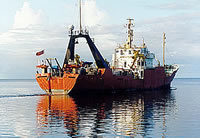
 Farnella |
| Title | Survey Equipment | Description |
|---|---|---|
| Cruise report | (document not focused on specific equipment) | Chief Technician's cruise report including personnel, objectives, navigation, and tabulated information. |
| Survey Equipment | Survey Info | Data Type(s) | Data Collected |
|---|---|---|---|
| Loran-C | --- | Navigation | |
| GEOPROBE | --- | Mooring (physical oceanography) | 1989-009-FA-OM-001 (mooring data) |