Other ID: OC222
Status: Completed
Organization(s): USGS, Woods Hole Coastal and Marine Science Center
Funding Program(s):
Principal Investigator(s): Michael Bothner
Affiliate Investigator(s): J. Frederick Grassle - Rutgers U.
Information Specialist(s):
Data Type(s): Biological Field Study: Experiments (biological), Sampling: Geology, Sonar: Single Beam, Time Series: Mooring (physical oceanography)
Scientific Purpose/Goals: Recover two subsurface moorings from the dump site which were deployed in September 1989. Collect sediment samples for studies of benthic infauna, microbiology, heavy metal and organic geochemistry. Overall objective of the sampling is to extend our study (initial survey on ATLANTIS cruise 122) of the sea floor to determine where particles from sewage sludge are being deposited as a result of discharge in the dump site (2,250-2,750 m water depth). Samples were also taken in control sites to the northeast of Hudson Canyon at about 2,500 m water depth. Reoccupied two sites on the southern flank of Georges Bank for coring and grab sampling.
Vehicle(s):
Start Port/Location: Woods Hole, MA
End Port/Location: Woods Hole, MA
Start Date: 1990-08-02
End Date: 1990-08-07
Equipment Used: Box corer, Slow corer, Van Veen grab sampler, Piston corer, 12 kHz, Bottom platform
Information to be Derived: Time series data; Samples and chemical analysis; Grain size analysis; Suspended sediment concentrations;
Summary of Activity and Data Gathered: Moorings recovered: 2 (#336 and 337, deployed FA 89027 ATL2 AII222 Sep. 15-26, 1989). Box cores: 15; Van Veen grab samples: 6; Hydraulically-damped gravity cores: 6; Piston cores: 3.
Staff: Michael Bothner, Adam Brown, Marinna Martini, Carol M. Parmenter
Affiliate Staff:
Fred Grassle - Rutgers; Rose Petrecca - Rutgers; Mike DeLuca - Rutgers; Peter Mills - WHOI; Carla Curran - WHOI; Russell Hill - U. Maryland; Ivor Knight - U. Maryland; Russell Winchell - Ocean Taxonomic Services
Notes: Original Submitted By field contained: Dr. J. Frederick Grassle.
Project = NJ Marine Ecosystems Observatory: Sewage Site / Georges Bank Monitoring, NJ Marine Ecosystems Observatory: Sewage Site / Georges Bank Monitoring
Location:
Continental Slope off New Jersey, Deep Water Dump Site DWDS 106, southern flank of Georges Bank, United States, North America, North Atlantic;
| Boundaries | |||
|---|---|---|---|
| North: 39.14 | South: 38.5 | West: -72.34 | East: -71.166 |
Platform(s):
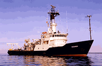
 Oceanus |
| Title | Survey Equipment | Description |
|---|---|---|
| Cruise report | (document not focused on specific equipment) | Chief scientist's cruise report including personnel, purpose, equipment, station data sheets, location maps, and bridge log. |
| Cruise report | (document not focused on specific equipment) | Ship cruise report including personnel and trackmap. |
| Survey Equipment | Survey Info | Data Type(s) | Data Collected |
|---|---|---|---|
| Box corer | --- | Biology Geology | |
| Slow corer | --- | Geology | 1990-026-FA-SC-001 (CORE samples) |
| Van Veen grab sampler | --- | Geology | |
| Piston corer | --- | Geology | |
| 12 kHz | --- | Single Beam | 1990-026-FA-SE-001 ( Collection of paper record displays of seismic data( 12K) for lines ) |
| Bottom platform | --- | Mooring (physical oceanography) | 1990-026-FA-OM-001 (site 106 mooring data) |