Other ID: MNRO91-1,M-1A-91-GM
Status: Completed
Organization(s): USGS, Woods Hole Coastal and Marine Science Center
Funding Program(s):
Principal Investigator(s): William J. Strahle, Marlene Noble
Affiliate Investigator(s): Marlene Noble - USGS PMG-Menlo Park
Information Specialist(s):
Data Type(s): Location-Elevation: Navigation, Time Series: Mooring (physical oceanography)
Scientific Purpose/Goals: Exchange moorings
Vehicle(s):
Start Port/Location: Biloxi, MS
End Port/Location: Biloxi, MS
Start Date: 1991-05-08
End Date: 1991-05-08
Equipment Used: Loran-C, Bottom platform, navigation
Information to be Derived: Time series data;
Summary of Activity and Data Gathered: Mooring recovered: 1 (#365, deployed FA 90050 TOMMY MUNRO Dec. 12, 1990).
Staff: William J. Strahle, Marinna Martini
Affiliate Staff:
Dauphin Island Sea Lab: A. Gunter (deckhand)
J. Busby (deckhand)
R. Schreiber (deckhand)
A. Gunter (Dauphin Island Sea Lab) - Deckhand
J. Busby (Dauphin Island Sea Lab) - Deckhand
R. Schreiber (Dauphin Island Sea Lab) - Deckhand
L. Ladnier (Gulf Coast Research Center) - Captain
L. Ladnier (Gulf Coast Research Center) - Captain
A. Gunter (Dauphin Sea Lab) - Deck Hand
H. Sarvis (Dauphin Sea Lab) - Deck Hand
Notes: Original Center People field contained: William Strahle (deckhand).
Project = AL-MS Circulation (Gelfenbaum - St. Pete), AL-MS Circulation (Gelfenbaum - St. Pete)
Staff information imported from InfoBank
Bill Strahle (USGS Woods Hole) - Chief Scientist
Marlene Noble (USGS Western Region) - Chief Scientist
A. Gunter (Dauphin Island Sea Lab) - Deckhand
J. Busby (Dauphin Island Sea Lab) - Deckhand
R. Schreiber (Dauphin Island Sea Lab) - Deckhand
L. Ladnier (Gulf Coast Research Center) - Captain
Staff information imported from InfoBank
Bill Strahle (USGS Woods Hole) - Chief Scientist
L. Ladnier (Gulf Coast Research Center) - Captain
Marinna Martini (USGS Woods Hole) - Deck Hand
A. Gunter (Dauphin Sea Lab) - Deck Hand
H. Sarvis (Dauphin Sea Lab) - Deck Hand
Location:
Gulf of America (Gulf of Mexico)
| Boundaries | |||
|---|---|---|---|
| North: 29.96424217 | South: 29.95112524 | West: -88.18095425 | East: -88.1657622 |
Platform(s):
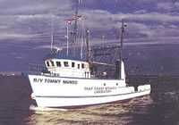 Tommy Munro |
| Title | Survey Equipment | Description |
|---|---|---|
| Cruise report | (document not focused on specific equipment) | Chief Scientist's cruise report including personnel, purpose, tabulated information, |
| Survey Equipment | Survey Info | Data Type(s) | Data Collected |
|---|---|---|---|
| Loran-C | --- | Navigation | |
| Bottom platform | --- | Mooring (physical oceanography) | 1991-006-FA-OM-001 (mooring data) |
| navigation | --- | Navigation |
