Other ID: W6-91
Status: Completed
Organization(s): USGS, Woods Hole Coastal and Marine Science Center
Funding Program(s):
Principal Investigator(s): Michael Bothner
Affiliate Investigator(s):
Information Specialist(s):
Data Type(s): Imagery: Photo, Sampling: Biology, Sampling: Geology, Time Series: Mooring (physical oceanography)
Scientific Purpose/Goals: This cruise will be the sixth in the two year program jointly funded by the USGS and the Massachusetts Water Resources Authority. The U.S. Coast Guard is generously providing ship time and at-sea support. The objective of the program is to conduct long-term monitoring of currents, sediment transport, and physical/chemical characteristics of sediments in western Massachusetts Bay.
Vehicle(s):
Start Port/Location: USCG Base, Boston, MA
End Port/Location: USCG Base, Boston, MA
Start Date: 1991-06-11
End Date: 1991-06-12
Equipment Used: Slow corer, Van Veen grab sampler, Box corer, Camera- deep sea, Bottom platform
Information to be Derived: Time series data; Samples and chemical analysis; Suspended sediment concentrations;
Summary of Activity and Data Gathered: Moorings recovered: 2 (#374 and 375, both deployed FA 91005 WHITE HEATH Feb. 12-13, 1991). Moorings deployed: 2 (#383 and 384 recovered FA 91036 WHITE HEATH Oct. 16-17, 1991).
Staff: Michael Bothner, Adam Brown, Barry Irwin, Marinna Martini, David Nichols, Carol M. Parmenter, Richard Rendigs, William J. Strahle
Affiliate Staff:
Mike Michelson - MWRA
Notes: No post-cruise report; information derived from pre-cruise report and mooring log.
Information from Foghorn: The hydraulically damped corer, a teflon coated Van Veen grab sampler, and a box core will be used to collect bottom sediments. Currents and sediment transport measurements will be made with Butmans upgraded moored equipment. A time-series sediment trap and a remotely operated suspended matter sampler (both made by McLean Associates) will be deployed on the subsurface moorings. Eight tube traps and 1 Anderson trap will be attached to the moorings. The two new navigation systems will be new additions for this cruise. We would like to record LORAN-C data as well.;
Location:
western Massachusetts Bay, Massachusetts, United States, North America, North Atlantic;
| Boundaries | |||
|---|---|---|---|
| North: 42.4 | South: 42.3 | West: -70.8 | East: -70.7 |
Platform(s):
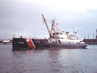 White Heath |
Bothner, M.H., Buchholtz ten Brink, M.R., Butman, B., Knebel, H.J., Manheim, F.T., and Signell, R.P., 1994, Circulation and contaminant transport in Massachusetts coastal waters—A summary of achievements and future plans: U.S. Geological Survey Open-File Report 94-649, https://doi.org/10.3133/ofr94649.
Bothner, M.H., and Butman, Bradford (eds.), 2007, Processes influencing the transport and fate of contaminated sediments in the coastal ocean—Boston Harbor and Massachusetts Bay: U.S. Geological Survey Circular 1302, 89 p., https://doi.org/10.3133/cir1302.
Butman, B., Sherwood, C.R., and Dalyander, P.S., 2008, Northeast storms ranked by wind stress and wave-generated bottom stress observed in Massachusetts Bay, 1990-2006: Continental Shelf Research, v. 28 no. 10-11, doi: 10.1016/j.csr.2008.02.010.
Butman, B., Bothner, M.H., Alexander, P.S., Lightsom, F.L., Martini, M.A., Gutierrez, B.T., and Strahle, W.S., 2004, Long-term oceanographic observations in western Massachusetts Bay offshore of Boston, Massachusetts; data report for 1989-2002: U.S. Geological Survey Digital Data Series DDS-74, Version 2.0, DVD-ROM, URL: https://doi.org/10.3133/ds74_v2.
Butman, B., Dalyander, P.S., Bothner, M.H., Borden, J., Casso, M.A., Gutierrez, B.T., Hastings, M.E., Lightsom, F.L., Martini, M.A., Montgomery, E.T., Rendigs, R.R., and Strahle, W.S., 2009, Long-term oceanographic observations in Massachusetts Bay, 1989 - 2006 (version 3): U.S. Geological Survey Data Series 74, https://doi.org/10.3133/ds74.
Butman, B., Dalyander, P.S., Bothner, M.H., and Lang, W.N., 2008, Time-series photographs of the sea floor in western Massachusetts Bay, version 2, 1989 - 1996: U.S. Geological Survey Data Series 265, https://doi.org/10.3133/ds265.
Warner, J.C., Butman, B., and Dalyander, P. S., 2008, Storm-driven sediment transport in Massachusetts Bay: Continental Shelf Research, v. 28 no. 2, doi: 10.1016/j.csr.2007.08.008.
Warner, J.C., Sherwood, Christopher R., Signell, Richard P., Harris, Courtney K., and Arango, Hernan G., 2008, Development of a three-dimensional, regional, coupled wave, current, and sediment-transport model: Computers and Geosciences, v. 34 no. 10, doi: 10.1016/j.cageo.2008.02.012.
| Survey Equipment | Survey Info | Data Type(s) | Data Collected |
|---|---|---|---|
| Slow corer | --- | Geology | |
| Van Veen grab sampler | --- | Geology | |
| Box corer | --- | Biology Geology | |
| Camera- deep sea | --- | Photo | 1991-016-FA-PH-001 (film collection of TRIPOD 383; 19910611-19911016) |
| Bottom platform | --- | Mooring (physical oceanography) | 1991-016-FA-OM-001 (Western Mass Bay mooring data) |
