Other ID: none
Status: Completed
Organization(s): USGS, Woods Hole Coastal and Marine Science Center
Funding Program(s):
Principal Investigator(s): Marinna Martini
Affiliate Investigator(s):
Information Specialist(s):
Data Type(s): Time Series: Mooring (physical oceanography)
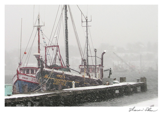
Scientific Purpose/Goals: Historic fishing vessel dragged and recovered subsurface mooring #369 in Massachusetts Bay.
Vehicle(s):
Start Port/Location: Gloucester, MA
End Port/Location: Gloucester, MA
Start Date: 1991-04-27
End Date: 1991-04-27
Equipment Used: Bottom platform
Information to be Derived: Time series data;
Summary of Activity and Data Gathered: Mooring dragged and recovered by fisherman aboard historic fishing vessel. No USGS personnel. Mooring recovered by fisherman: 1 (#369, deployed FA 91003 OCEANUS Jan. 31 - Feb. 1, 1991).
Staff:
Affiliate Staff:
Notes:
Location:
Massachusetts Bay, Massachusetts, United States, North America, North Atlantic,
| Boundaries | |||
|---|---|---|---|
| North: 42.36520989 | South: 42.34468774 | West: -70.4107181 | East: -70.38079126 |
Platform(s):
 Vincie N |
Bothner, M.H., and Butman, Bradford (eds.), 2007, Processes influencing the transport and fate of contaminated sediments in the coastal ocean—Boston Harbor and Massachusetts Bay: U.S. Geological Survey Circular 1302, 89 p., https://doi.org/10.3133/cir1302.
Hotchkiss, F.S., and Signell, R.P., 1991, Average near-bottom currents in Massachusetts Bay and Cape Cod Bay measured with Woodhead drifters; progress report for drifters released Sept. 1990 through May 1991: U.S. Geological Survey Open-File-Report 91-361, 14 p., URL: https://doi.org/10.3133/ofr91361.
| Survey Equipment | Survey Info | Data Type(s) | Data Collected |
|---|---|---|---|
| Bottom platform | --- | Mooring (physical oceanography) | 1991-046-FA-OM-001 (Mass Bay Circulation mooring data) |