Other ID: 93-1
Status: Completed
Organization(s): USGS, Woods Hole Coastal and Marine Science Center
Funding Program(s):
Principal Investigator(s): Richard Signell
Affiliate Investigator(s):
Information Specialist(s):
Data Type(s): Environmental Data: CTD, Time Series: Mooring (physical oceanography)
Scientific Purpose/Goals: Deploy 3 moorings (Stations MC, MP, CP), conduct CTD casts, and collect red tide samples.
Vehicle(s):
Start Port/Location: Boothbay Harbor, ME
End Port/Location: Boothbay Harbor, ME
Start Date: 1993-03-19
End Date: 1993-03-20
Equipment Used: CTD 19+ with OBS, PAR, DO, Chl, Bottom platform
Information to be Derived: Time series data;
Summary of Activity and Data Gathered: Moorings deployed: 3 (#415, 416, and 417, all recovered ARGO MAINE FA 93013 Jul. 8-9, 1993). CTD casts: 7. Nutrient and Red Tide samples: 4.
Staff: Joseph S. Newell, Carol M. Parmenter, Richard Rendigs, Richard Signell, William J. Strahle
Affiliate Staff:
Notes: Project = western Gulf of Maine, western Gulf of Maine
Location:
Monhegan, Cape Porpoise, western Gulf of Maine, United States, North America, North Atlantic;
| Boundaries | |||
|---|---|---|---|
| North: 43.65 | South: 43.3 | West: -70.3 | East: -69.25 |
Platform(s):
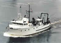 Argo Maine |
| Title | Survey Equipment | Description |
|---|---|---|
| Cruise report | (document not focused on specific equipment) | Chief Scientist's cruise including personnel, and daily log which includes station location and work performed. |
| Survey Equipment | Survey Info | Data Type(s) | Data Collected |
|---|---|---|---|
| CTD 19+ with OBS, PAR, DO, Chl | --- | CTD | |
| Bottom platform | --- | Mooring (physical oceanography) | 1993-004-FA-OM-001 (ECOHAB I Mooring data) |
