Other ID: S-1-94-MB
Status: Completed
Organization(s): USGS, Woods Hole Coastal and Marine Science Center
Funding Program(s):
Principal Investigator(s): William J. Strahle
Affiliate Investigator(s): Marlene Noble - PMG; Leslie Rosenfeld - MBARI
Information Specialist(s):
Data Type(s): Time Series: Mooring (physical oceanography)
Scientific Purpose/Goals: Recover current meter array and exchange single current meter mooring.
Vehicle(s):
Start Port/Location: Moss Landing, CA
End Port/Location: Moss Landing, CA
Start Date: 1994-08-17
End Date: 1994-08-21
Equipment Used: Bottom platform
Information to be Derived: Time series data;
Summary of Activity and Data Gathered: Moorings recovered: 6 (#422, 423, 424, 425, 426, and 427 all deployed ROBERT GORDON SPROUL FA 93016 Aug. 1-4, 1993). Moorings deployed: 1 (#444 recovered FA 95030 MCARTHUR May 15-18, 1995).
Staff: Marinna Martini, Richard Rendigs, William J. Strahle
Affiliate Staff:
Marlene Noble - PMG
Leslie Rosenfeld - MBARI
Notes: This was a Menlo Park cruise.
Location:
Monterey Canyon, California, United States, North America, North Pacific;
| Boundaries | |||
|---|---|---|---|
| North: 36.75 | South: 36.45 | West: -122.4 | East: -122 |
Platform(s):
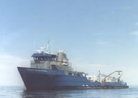 Robert Gordon Sproul |
| Survey Equipment | Survey Info | Data Type(s) | Data Collected |
|---|---|---|---|
| Bottom platform | --- | Mooring (physical oceanography) | 1994-016-FA-OM-001 (mooring data) |
