Other ID: P-2-98-MB
Status: Completed
Organization(s): USGS, Woods Hole Coastal and Marine Science Center
Funding Program(s):
Principal Investigator(s): William J. Strahle
Affiliate Investigator(s): Dr. Marlene Noble, USGS
Information Specialist(s): PARTNER
Data Type(s): Time Series: Mooring (physical oceanography)
Scientific Purpose/Goals: Recover tripod and surface mooring #527 and 528.
Vehicle(s):
Start Port/Location: Moss Landing, CA
End Port/Location: Moss Landing, CA
Start Date: 1998-08-17
End Date: 1998-08-24
Equipment Used: Bottom platform
Information to be Derived: Time series data;
Summary of Activity and Data Gathered: Moorings recovered: 2 (#527 and 528 deployed FA 98023 POINT SUR Apr. 1-3, 1998).
Staff: William J. Strahle
Affiliate Staff:
Notes: This pre-cruise report is generated solely for the purpose of authorizing overtime for the mobilization of the cruise. No Woods Hole personnel will be on the cruise. Original Center People field contained: William Strahle - mobilization and transportation.
Location:
Davenport, Monterey Bay, California, United States, North America, North Pacific;
| Boundaries | |||
|---|---|---|---|
| North: 37 | South: 36.95 | West: -122.25 | East: -122.2 |
Platform(s):
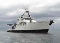
 Point Sur |
| Survey Equipment | Survey Info | Data Type(s) | Data Collected |
|---|---|---|---|
| Bottom platform | --- | Mooring (physical oceanography) | 1998-038-FA-OM-001 (mooring data) |