Other ID: MH32-00; IB H-2-00-MY
Status: Completed
Organization(s): USGS, Woods Hole Coastal and Marine Science Center
Funding Program(s):
Principal Investigator(s): Michael Bothner
Affiliate Investigator(s):
Information Specialist(s): Michael Casso, Frances Lightsom
Data Type(s): Environmental Data: Dissolved Oxygen, Imagery: Photo, Imagery: Video, Location-Elevation: Navigation, Sampling: Geology, Time Series: Mooring (physical oceanography)
Scientific Purpose/Goals: Mooring turn-around and sediment sampling.
Vehicle(s):
Start Port/Location: Boston, MA
End Port/Location: Boston, MA
Start Date: 2000-02-15
End Date: 2000-02-16
Equipment Used: Oxygen profiling system from Sayles, GPS (wh), Video camera - deep sea, Camera- deep sea, Gravity corer, Bottom platform
Information to be Derived:
Summary of Activity and Data Gathered: Moorings 590-592 were recovered. Mooring 593 did not release and will be recovered at a later date. Divers were not utilized. Moorings deployed: 4 (#611, 612, 613 and 614, all recovered FA 00003 MARCUS HANNA May 9-10, 2000). Moorings recovered: 3 (#590, 591 and 592, all deployed FA 99009 MARCUS HANNA Sep. 21-22, 1999).
Staff: Robert Barton, Dann Blackwood, Jonathan Borden, Michael Bothner, Bradford Butman, Michael Casso, Jessica M. Cote, Marinna Martini, Joseph S. Newell, Richard Rendigs, David Walsh
Affiliate Staff:
Joanne Goudreau - WHOI
Notes: Rick Rendigs, Dive Safety Officer for the center, and Dann Blackwood will be divers should an instrument fail to come up. Original Center People field contained: Science Crew, USGS: Jonathan Borden, Mike Bothner, Brad Butman, Dann Blackwood, Michael Casso, Jessica Cote, David Walsh, Marinna Martini, Richard Rendigs. Mobilization: Joseph Newell, Robert Barton. Original Submitted By field contained: Mike Bothner; edited by Jessica Cote.
Project = Massachusetts Bay Long-Term Study, Massachusetts Bay Long-Term Study
Location:
Massachusetts Bay, Massachusetts, United States, North America, North Atlantic,
| Boundaries | |||
|---|---|---|---|
| North: 42.39529101 | South: 42.15893566 | West: -70.84131488 | East: -70.62935908 |
Platform(s):
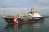 Marcus Hanna |
Bothner, M.H., and Butman, Bradford (eds.), 2007, Processes influencing the transport and fate of contaminated sediments in the coastal ocean—Boston Harbor and Massachusetts Bay: U.S. Geological Survey Circular 1302, 89 p., https://doi.org/10.3133/cir1302.
Butman, B., Bothner, M.H., Alexander, P.S., Lightsom, F.L., Martini, M.A., Gutierrez, B.T., and Strahle, W.S., 2004, Long-term oceanographic observations in western Massachusetts Bay offshore of Boston, Massachusetts; data report for 1989-2002: U.S. Geological Survey Digital Data Series DDS-74, Version 2.0, DVD-ROM, URL: https://doi.org/10.3133/ds74_v2.
Butman, B., Dalyander, P.S., Bothner, M.H., Borden, J., Casso, M.A., Gutierrez, B.T., Hastings, M.E., Lightsom, F.L., Martini, M.A., Montgomery, E.T., Rendigs, R.R., and Strahle, W.S., 2009, Long-term oceanographic observations in Massachusetts Bay, 1989 - 2006 (version 3): U.S. Geological Survey Data Series 74, https://doi.org/10.3133/ds74.
Butman, B., Dalyander, P.S., Bothner, M.H., and Lange, W.N., 2008, Time-series photographs of the sea floor in western Massachusetts Bay, 1996 - 2005: U.S. Geological Survey Data Series 266, https://doi.org/10.3133/ds266.
Warner, J.C., Butman, B., and Dalyander, P. S., 2008, Storm-driven sediment transport in Massachusetts Bay: Continental Shelf Research, v. 28 no. 2, doi: 10.1016/j.csr.2007.08.008.
Warner, J.C., Sherwood, Christopher R., Signell, Richard P., Harris, Courtney K., and Arango, Hernan G., 2008, Development of a three-dimensional, regional, coupled wave, current, and sediment-transport model: Computers and Geosciences, v. 34 no. 10, doi: 10.1016/j.cageo.2008.02.012.
| Survey Equipment | Survey Info | Data Type(s) | Data Collected |
|---|---|---|---|
| Oxygen profiling system from Sayles | --- | Dissolved Oxygen | |
| GPS (wh) | --- | Navigation | |
| Video camera - deep sea | --- | Video | |
| Camera- deep sea | --- | Photo | 2000-002-FA-PH-001 (Deck photos of field activity operations) |
| Gravity corer | --- | Geology | 2000-002-FA-SC-001 (CORE samples) |
| Bottom platform | --- | Mooring (physical oceanography) | 2000-002-FA-OM-001 (Western Mass Bay mooring data) |
