Other ID: IB H-51-00-GU
Status: Completed
Organization(s): USGS, Woods Hole Coastal and Marine Science Center
Funding Program(s):
Principal Investigator(s): Jason Hyatt
Affiliate Investigator(s): David Townsend, John Wallinga - University of Maine
Information Specialist(s): Frances Lightsom
Data Type(s): Location-Elevation: Navigation, Time Series: Mooring (physical oceanography)
Scientific Purpose/Goals: Deploy 2 remaining USGS moorings in western Maine Coastal Current system.
Vehicle(s):
Start Port/Location: Portland, ME
End Port/Location: Portland, ME
Start Date: 2000-04-23
End Date: 2000-05-03
Equipment Used: Bottom platform, GPS (wh)
Information to be Derived:
Summary of Activity and Data Gathered: Moorings deployed: 2 (#622 and 623 both recovered FA 00025 CAPE HATTERAS Aug. 13-16, 2000).
Staff: Jason Hyatt
Affiliate Staff:
Notes: USGS Mooring Deployments: USGS1: 43 36.67 N, 069 51.89 W; USGS2: 43 42.02 N, 069 21.29 W.
Project = ECOHAB - Gulf of Maine, ECOHAB - Gulf of Maine
Location:
Gulf of Maine, United States, North America, North Atlantic,
| Boundaries | |||
|---|---|---|---|
| North: 43.83687944 | South: 43.48911397 | West: -69.5297 | East: -68.99273682 |
Platform(s):
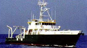
 Cape Hatteras |
| Survey Equipment | Survey Info | Data Type(s) | Data Collected |
|---|---|---|---|
| Bottom platform | --- | Mooring (physical oceanography) | 2000-051-FA-OM-001 (ECOHAB II mooring data) |
| GPS (wh) | --- | Navigation |