Other ID: IB C-88-00-GU
Status: Completed
Organization(s): USGS, Woods Hole Coastal and Marine Science Center
Funding Program(s):
Principal Investigator(s): Marinna Martini
Affiliate Investigator(s): Bruce Keafer - WHOI
Information Specialist(s):
Data Type(s): Time Series: Mooring (physical oceanography)
Scientific Purpose/Goals: Deploy 3 moorings in Gulf of Maine at MUSL sites 2, 3 and 6.
Vehicle(s):
Start Port/Location:
End Port/Location:
Start Date: 2000-04-11
End Date: 2000-04-11
Equipment Used: Bottom platform
Information to be Derived: Time series data; Biological samples;
Summary of Activity and Data Gathered: Moorings deployed: 3 (#619, 620 and 621; no recovery information; note Aug. 15, 2000, #621 no useable data).
Staff:
Affiliate Staff:
Notes: No activity reports; information derived from mooring logbook.
Location:
Gulf of Maine, United States, North America, North Atlantic,
| Boundaries | |||
|---|---|---|---|
| North: 43.85 | South: 43.35 | West: -69.9 | East: -69.25 |
Platform(s):
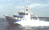 Gulf Challenger |
| Survey Equipment | Survey Info | Data Type(s) | Data Collected |
|---|---|---|---|
| Bottom platform | --- | Mooring (physical oceanography) | 2000-088-FA-OM-001 (ECOHAB II mooring data) |
