Other ID: MH36-01; IB H-3-01-MY
Status: Completed
Organization(s): USGS, Woods Hole Coastal and Marine Science Center
Funding Program(s):
Principal Investigator(s): Michael Bothner
Affiliate Investigator(s): William Martin - WHOI
Information Specialist(s): Michael Casso, Frances Lightsom
Data Type(s): Environmental Data: Dissolved Oxygen, Geochemical: Experiments (geochemical), Imagery: Photo, Imagery: Video, Location-Elevation: Navigation, Sampling: Geology, Time Series: Mooring (physical oceanography)
Scientific Purpose/Goals: Exchange moorings, collect sediment cores, and deploy oxygen profiler and benthic chambers.
Vehicle(s):
Start Port/Location: U.S. Coast Guard Base, Boston, MA
End Port/Location: U.S. Coast Guard Base, Boston, MA
Start Date: 2001-05-23
End Date: 2001-05-24
Equipment Used: Benthic Chambers, Oxygen profiling system from Sayles, DGPS, Van Veen grab sampler, Slow corer, Osprey camera system, Digital camera, Bottom platform
Information to be Derived:
Summary of Activity and Data Gathered: Extra cores collected at Station 3 for Bill Martin's team for processing at the Coast Guard dock. Problem with bottom sealing mechanism (cheese slicer) on HDC corer, especially at Station 2. Successfully deployed both WHOI benthic chambers at Station 3 using mini-camera setup. Moorings deployed: 6 (#644 and 645 both recovered FA 01024 MARCUS HANNA Oct. 23, 2001; #646 and 647 recovered FA 01080 CHRISTOPHER ANDREW Oct. 26-30, 2001; #648 recovered FA 01061 CHRISOPHER ANDREW Jun. 20, 2001; #649 recovered FA 01068 CHRISTPHER ANDREW Aug. 16, 2001, then redeployed and recovered FA 01085 CHRISTOPHER ANDREW Dec. 5, 2001). Moorings recovered: 3 (#637, 638 and 639 all deployed FA 01022 MARCUS HANNA Feb. 13-14, 2001).
Staff: Dann Blackwood, Jonathan Borden, Michael Bothner, Michael Casso, Deborah Hutchinson, Marinna Martini, Joseph S. Newell, Andree Ramsey, Richard Rendigs, David Walsh
Affiliate Staff:
Volunteers: Wayne LaFlamboy
Katherine Bothner; WHOI: William Martin
Joanne Goudreau
Ida-Maja Karle
Notes: Note: Cruise delayed 1 day from original plan. Original Center People field contained: At sea: Jonathan Borden*, Mike Bothner, Dann Blackwood, Michael Casso, Marinna Martini*, Richard Rendigs, David Walsh*, Andree Ramsey*, Debbie Hutchinson. Mob and Transport: Joseph Newell*. Asterisk (*) denotes acct. 67013; otherwise acct. 67011.
Project = The Massachusetts Bay Experiment, The Massachusetts Bay Experiment
Location:
Massachusetts Bay, Scituate, Massachusetts, United States, North America, North Atlantic;
| Boundaries | |||
|---|---|---|---|
| North: 42.39762911 | South: 42.37139652 | West: -70.83865268 | East: -70.80211271 |
Platform(s):
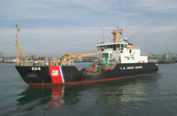 Marcus Hanna |
Bothner, M.H., and Butman, Bradford (eds.), 2007, Processes influencing the transport and fate of contaminated sediments in the coastal ocean—Boston Harbor and Massachusetts Bay: U.S. Geological Survey Circular 1302, 89 p., https://doi.org/10.3133/cir1302.
Butman, B., Bothner, M.H., Alexander, P.S., Lightsom, F.L., Martini, M.A., Gutierrez, B.T., and Strahle, W.S., 2004, Long-term oceanographic observations in western Massachusetts Bay offshore of Boston, Massachusetts; data report for 1989-2002: U.S. Geological Survey Digital Data Series DDS-74, Version 2.0, DVD-ROM, URL: https://doi.org/10.3133/ds74_v2.
Butman, B., Dalyander, P.S., Bothner, M.H., Borden, J., Casso, M.A., Gutierrez, B.T., Hastings, M.E., Lightsom, F.L., Martini, M.A., Montgomery, E.T., Rendigs, R.R., and Strahle, W.S., 2009, Long-term oceanographic observations in Massachusetts Bay, 1989 - 2006 (version 3): U.S. Geological Survey Data Series 74, https://doi.org/10.3133/ds74.
Butman, B., Dalyander, P.S., Bothner, M.H., and Lange, W.N., 2008, Time-series photographs of the sea floor in western Massachusetts Bay, 1996 - 2005: U.S. Geological Survey Data Series 266, https://doi.org/10.3133/ds266.
Rendigs, R.R., and Bothner, M.H., 2002, Temporal changes in grain size and organic-mineral aggregates in surficial sediments near the Massachusetts Bay outfall Site: U.S. Geological Survey Open-File Report 2001-499, https://doi.org/10.3133/ofr01499.
Warner, J.C., Butman, B., and Dalyander, P. S., 2008, Storm-driven sediment transport in Massachusetts Bay: Continental Shelf Research, v. 28 no. 2, doi: 10.1016/j.csr.2007.08.008.
Warner, J.C., Sherwood, Christopher R., Signell, Richard P., Harris, Courtney K., and Arango, Hernan G., 2008, Development of a three-dimensional, regional, coupled wave, current, and sediment-transport model: Computers and Geosciences, v. 34 no. 10, doi: 10.1016/j.cageo.2008.02.012.
| Survey Equipment | Survey Info | Data Type(s) | Data Collected |
|---|---|---|---|
| Benthic Chambers | --- | Experiments (geochemical) | |
| Oxygen profiling system from Sayles | --- | Dissolved Oxygen | |
| DGPS | --- | Navigation | |
| Van Veen grab sampler | --- | Geology | |
| Slow corer | --- | Geology | 2001-023-FA-SC-001 (CORE samples) |
| Osprey camera system | --- | Photo Video | |
| Digital camera | --- | Photo | 2001-023-FA-PH-001 (Deck photos of field activity operations) |
| Bottom platform | --- | Mooring (physical oceanography) | 2001-023-FA-OM-001 (Western Mass Bay mooring data) |
