Other ID: PASTA Leg 3
Status: Completed
Organization(s): USGS, Woods Hole Coastal and Marine Science Center
Funding Program(s):
Principal Investigator(s): Christopher Sherwood
Affiliate Investigator(s): Chuck Nittrouer, UW; Rocky Geyer, WHOI; Paul Hill, Dalhousie
Information Specialist(s): Frances Lightsom
Data Type(s): Environmental Data: CTD, Environmental Data: Current, Environmental Data: Temperature, Location-Elevation: Navigation, Sampling: Biology, Sampling: Geology, Time Series: Mooring (physical oceanography)
Scientific Purpose/Goals: Deploy EuroSTRATAFORM tripods (moorings #701, 702 and 703); assist others with seabed and water column sampling; USGS thermistors deployed by Cacchione and Puig (mooring #700).
Vehicle(s):
Start Port/Location: Ravenna, Italy
End Port/Location: Ravenna, Italy
Start Date: 2002-11-07
End Date: 2002-11-13
Equipment Used: Kasten corer, SBE 9 CTD, DGPS, Bottom platform, Temperature and salinity, Pressure, Turbidity, Current, ADCP, Box corer
Information to be Derived: Time series data; Grain size analysis; Suspended sediment concentrations;
Summary of Activity and Data Gathered: Heavy fishing pressure - extra guard buoys. Leg 3 moorings deployed: 3 (#701, 702 and 703 all recovered FA 03011 SEWARD JOHNSON Feb. 11-22, 2003). Cruise Legs 1, 2 and 3 Summary: 24 Oct. - loaded ship in Ravenna. 25-28 Oct. - Leg 1a (UW, ICM, OSU, IGM), 2 tripods, 1 mooring and 6 guard buoys were deployed near Po and Pescara; seabed coring and water column profiling occurred at night. 28 Oct. - 4 Nov. - Leg 1b (UW, IGM, OSU, ICM), seabed coring and water column profiling extended from Gargano to Po. 5-7 Nov. - Leg 2 (WHOI, IGM, ICM, UW), 4 tripods and 6 guard buoys were deployed near the Po and Ravenna; water column profiling occurred at night. 7-13 Nov. - Leg 3 (USGS, IGM, Dalhousie, WHOI, ICM), 3 tripods and 4 guard buoys were deployed near the Chienti; water-column profiling extended from Gargano to Po. 14 Nov. - unloaded ship in Ravenna.
Staff: Jonathan Borden, Christopher Sherwood
Affiliate Staff:
Joanne Ferreira - technician (Leg 3); Dave Rubin - camera scientist (Leg 3); Scientists and technicians from 12 institutions
Notes: Original Center People field contained: Christopher Sherwood - Chief Scientist, tripod scientist (Leg 3); Jonathan Borden - technician (Leg 2 only).
Project = EuroSTRATAFORM, EuroSTRATAFORM
Location:
Chienti River, Civitinova, Italy, Adriatic Sea, Mediterranean Sea, Europe, North Atlantic;
| Boundaries | |||
|---|---|---|---|
| North: 44.95848179 | South: 41.9662442 | West: 13.2056 | East: 14.93815104 |
Platform(s):
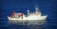
 Garcia Del Cid |
Carniel, S., Warner, John C., Chiggiato, Jacopo, and Sclavo, Mauro, 2009, Investigating the impact of surface wave breaking on modeling the trajectories of drifters in the northern Adriatic Sea during a wind-storm event: Ocean Modelling, v. 30 no. 2-3, doi: 10.1016/j.ocemod.2009.07.001.
Montgomery, E., Sherwood, C., 2013, Studying seafloor bedforms using autonomous stationary imaging and profiling sonars: , OCEANS'13 MTS/IEEE Proceedings Paper. pp. 1–7 URL: http://ieeexplore.ieee.org/xpl/freeabs_all.jsp?arnumber=6741159&abstractAccess=no&userType=inst.
Sherwood, C.R., Book, Jeffrey W., Carniel, Sandro, Cavaleri, Luigi, Chiggiato, Jacopo, Das, Himangshu, Doyle, James D., Harris, Courtney K., Niedoroda, Alan W., Perkins, Henry, Poulain, Pierre-Marie, Pullen, Julie, Reed, Christopher W., Russo, Aniello, Sclavo, Mauro, Signell, Richard P., Traykovski, Peter, and Warner, John C., 2004, Sediment dynamics in the Adriatic Sea investigated with coupled models: Oceanography, v. 17 no. 4, URL: http://www.tos.org/oceanography/article/sediment-dynamics-in-the-adriatic-sea-investigated-withcoupledmodels.
Signell, R.P., Carniel, Sandro, Chiggiato, Jacopo, Janekovic, Ivica, Pullen, Julie, and Sherwood, Christopher R., 2008, Collaboration tools and techniques for large model datasets: Journal of Marine Systems, v. 69 no. 1-2, doi: 10.1016/j.jmarsys.2007.02.013.
| Survey Equipment | Survey Info | Data Type(s) | Data Collected |
|---|---|---|---|
| Kasten corer | --- | Geology | |
| SBE 9 CTD | --- | CTD | |
| DGPS | --- | Navigation | |
| Bottom platform | --- | Mooring (physical oceanography) | 2002-053-FA-OM-001 (mooring data) |
| Temperature and salinity | --- | CTD Temperature | |
| Pressure | --- | Mooring (physical oceanography) | |
| Turbidity | --- | Mooring (physical oceanography) | |
| Current | --- | Mooring (physical oceanography) | |
| ADCP | --- | Current | |
| Box corer | --- | Biology Geology |