Other ID: none
Status: Completed
Organization(s): USGS, Woods Hole Coastal and Marine Science Center
Funding Program(s):
Principal Investigator(s): E. Robert Thieler
Affiliate Investigator(s):
Information Specialist(s): Erika Hammar-Klose
Data Type(s): Imagery: Photo, Location-Elevation: Navigation, Sampling: Geology, Seismics: Boomer, Seismics: Sub Bottom Profiler, Sonar: Interferometric, Sonar: Sidescan
Scientific Purpose/Goals: Map inner shelf.
Vehicle(s):
Start Port/Location: Atlantic Beach, NC
End Port/Location: Atlantic Beach, NC
Start Date: 2003-06-17
End Date: 2003-07-01
Equipment Used: Klein 3000, Boomer, Van Veen grab sampler, Edgetech chirp subbottom profiler 512i, DGPS, SEA SWATHplus-M 234 kHz, Digital camera, HYPACK
Information to be Derived: Sea floor map; Bathymetric maps; Morphology;
Summary of Activity and Data Gathered: Sea floor mapping cruise; data on DVD.
Staff: William Danforth, Erika Hammar-Klose, Emily Himmelstoss, Barry Irwin, David Nichols, Thomas O'Brien, E. Robert Thieler
Affiliate Staff:
Lawrence Kooker - USGS (acq.); Courtney Schupp - VIMS (acq.)
Notes: Original Center People field contained: Rob Thieler (CS); Tom O'Brien (acq.); Lawrence Kooker (acq.); William Danforth (acq.); Erika Hammar-Klose (seismic); Emily Himmelstoss (sidescan); Dave Nichols, Barry Irwin (mob.).
Project = North Carolina Regional Coastal Erosion Studies, North Carolina Regional Coastal Erosion Studies
Information from Foghorn: acquisition and processing vans, Submetrix, boomer, SIS-1000, DGPS, HYPACK, Van Veen sampler, EdgeTech 512i, DF-1000;
Location:
Raleigh Bay, Cape Hatteras, North Carolina, United States, North America, North Atlantic;
| Boundaries | |||
|---|---|---|---|
| North: 35.36 | South: 34.48 | West: -76.75 | East: -75.38 |
Platform(s):
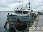
 Atlantic Surveyor |
Thieler, E.R., Foster, D.S., Mallinson, D.M., Himmelstoss, E.A., McNinch, J.E., List, J.H.,and Hammar-Klose, E.S., 2013, Quaternary geophysical framework of the northeastern North Carolina coastal system: U.S. Geological Survey Open-File Report 2011-1015, https://doi.org/10.3133/ofr20111015.
Thieler, E.R, Foster, D.S., Himmelstoss, E.A., and Mallinson, D.J., 2014, Geologic framework of the northern North Carolina, USA inner continental shelf and its influence on coastal evolution: Marine Geology, Vol. 348, 2014, pp. 113-130, https://doi.org/10.1016/j.margeo.2013.11.011.
| Survey Equipment | Survey Info | Data Type(s) | Data Collected |
|---|---|---|---|
| Klein 3000 | --- | Sidescan | iss2003003_tracklines (Sidescan sonar navigation from USGS cruise 2003-003-FA along the inner continental shelf of northern North Carolina) |
| Boomer | --- | Boomer | |
| Van Veen grab sampler | --- | Geology | |
| Edgetech chirp subbottom profiler 512i | --- | Sub Bottom Profiler | isc2003003_seismic_images (JPEG images of chirp seismic data along the inner continental shelf of northern North Carolina) isc2003003_shots (Chirp shotpoint navigation from USGS cruise 2003-003-FA along the inner continental shelf of northern North Carolina) isc2003003_tracklines (Tracklines of chirp subbottom data acquisition.) |
| DGPS | --- | Navigation | |
| SEA SWATHplus-M 234 kHz | --- | Interferometric | |
| Digital camera | --- | Photo | 2003-003-FA-PH-001 (Deck photos of field activity operations) |
| HYPACK | --- | Navigation |