Other ID: PASTA
Status: Completed
Organization(s): USGS, Woods Hole Coastal and Marine Science Center
Funding Program(s):
Principal Investigator(s): Christopher Sherwood
Affiliate Investigator(s): Office of Naval Research (funding); Chuck Nittrouer (Univ. of Washington)
Information Specialist(s): Frances Lightsom
Data Type(s): Imagery: Photo, Location-Elevation: Navigation, Sampling: Biology, Sampling: Geology, Time Series: Mooring (physical oceanography)
Scientific Purpose/Goals: Service EuroSTRATAFORM moorings and tripods; perform sidescan-sonar surveys.
Vehicle(s):
Start Port/Location: Ravenna, Italy
End Port/Location: Ravenna, Italy
Start Date: 2003-02-11
End Date: 2003-02-22
Equipment Used: Box corer, GPS (wh), Digital camera, Current
Information to be Derived: Time series data; Samples and chemical analysis; Grain size analysis; Suspended sediment concentrations; Sea floor map;
Summary of Activity and Data Gathered: Moorings recovered: 3 (#701, 702, and 703 all deployed FA 02053 GARCIA DEL CID Nov. 7-13, 2002). Moorings deployed: 3 (#711, 712, and 713 all recovered FA 03012 SEWARD JOHNSON II May 26 - Jun. 3, 2003). Sidescan survey: These data were returned to USGS-Woods Hole for processing.
Staff: Dann Blackwood, Marinna Martini, Christopher Sherwood, Charles Worley
Affiliate Staff:
Joanne Ferreira (USGS-Menlo)
Instrument tech; Hank Chezar (USGS-Menlo)
Instrument tech; Chuck Nittrouer
Univ. Washington
Project leader; Paul Hill
Dalhousie
P.I.; Rob Wheatcroft
OSU
P.I.; Pat Wiberg
U. Virginia
P.I.; Stefano Misserochi
IGM/CNR
P.I.; Andrea Ogston
U. Washington
P.I.; Gail Kineke
Boston College
P.I.; Rocky Geyer
WHOI
P.I.; Dick Sternberg
Univ. of Washington
P.I.; Peter Traykovski
WHOI
P.I.; Tim Milligan
Bedford Inst.
P.I.; Leo Langone
IGM/CNR
P.I.; Pere Puig
ICM/CSIC
P.I.
Notes: Diving in turbid water to 20 m. Original Center People field contained: Christopher Sherwood, Lead USGS Scientist; Marinna Martini, Instrument tech; Dann Blackwood, Backup diver, Photographer; Charles Worley, Backup diver, sidescan tech.
Project = EuroSTRATAFORM, EuroSTRATAFORM
Location:
Chienti River, Civitinova, Italy, Adriatic Sea, Mediterranean Sea, Europe, North Atlantic;
| Boundaries | |||
|---|---|---|---|
| North: 45.5 | South: 41.75 | West: 12.25 | East: 16.25 |
Platform(s):
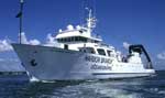 Seward Johnson II |
Carniel, S., Warner, John C., Chiggiato, Jacopo, and Sclavo, Mauro, 2009, Investigating the impact of surface wave breaking on modeling the trajectories of drifters in the northern Adriatic Sea during a wind-storm event: Ocean Modelling, v. 30 no. 2-3, doi: 10.1016/j.ocemod.2009.07.001.
Montgomery, E., Sherwood, C., 2013, Studying seafloor bedforms using autonomous stationary imaging and profiling sonars: , OCEANS'13 MTS/IEEE Proceedings Paper. pp. 1–7 URL: http://ieeexplore.ieee.org/xpl/freeabs_all.jsp?arnumber=6741159&abstractAccess=no&userType=inst.
Sherwood, C.R., Book, Jeffrey W., Carniel, Sandro, Cavaleri, Luigi, Chiggiato, Jacopo, Das, Himangshu, Doyle, James D., Harris, Courtney K., Niedoroda, Alan W., Perkins, Henry, Poulain, Pierre-Marie, Pullen, Julie, Reed, Christopher W., Russo, Aniello, Sclavo, Mauro, Signell, Richard P., Traykovski, Peter, and Warner, John C., 2004, Sediment dynamics in the Adriatic Sea investigated with coupled models: Oceanography, v. 17 no. 4, URL: http://www.tos.org/oceanography/article/sediment-dynamics-in-the-adriatic-sea-investigated-withcoupledmodels.
Signell, R.P., Carniel, Sandro, Chiggiato, Jacopo, Janekovic, Ivica, Pullen, Julie, and Sherwood, Christopher R., 2008, Collaboration tools and techniques for large model datasets: Journal of Marine Systems, v. 69 no. 1-2, doi: 10.1016/j.jmarsys.2007.02.013.
| Survey Equipment | Survey Info | Data Type(s) | Data Collected |
|---|---|---|---|
| Box corer | --- | Biology Geology | |
| GPS (wh) | --- | Navigation | |
| Digital camera | --- | Photo | 2003-011-FA-PH-001 (Deck photos of field activity operations) |
| Current | --- | Mooring (physical oceanography) | 2003-011-FA-OM-001 (mooring data) |
