Other ID: none
Status: Completed
Organization(s): USGS, Woods Hole Coastal and Marine Science Center
Funding Program(s):
Principal Investigator(s): Marinna Martini
Affiliate Investigator(s): University of South Carolina
Information Specialist(s): Frances Lightsom
Data Type(s): Visual Identification: Ground Truthing, Location-Elevation: Navigation, Environmental Data: CTD, Environmental Data: Temperature, Time Series: Mooring (physical oceanography)
Scientific Purpose/Goals: Deploy tripods #720, 722, 724, 726, 728, 730, 731, 732 and 733.
Vehicle(s):
Start Port/Location: Wilmington, NC
End Port/Location: Wilmington, NC
Start Date: 2003-10-27
End Date: 2003-10-28
Equipment Used: Mooring tripod, DGPS, Temperature and salinity, Pressure, Turbidity, Current
Information to be Derived:
Summary of Activity and Data Gathered: First deployment of tripods. No data will be available until the recovery. Moorings deployed: 9 (#720, 722, 724, 726, 728, 731, 732 and 733, all recovered FA 04007 DAN MOORE Jan. 20-30, 2004; #730 recovered FA 04008 DAN MOORE Apr. 23-24, 2004).
Staff: Jonathan Borden, Marinna Martini, Andree Ramsey, Stephen Ruane, John Warner, Robert Barton
Affiliate Staff:
Dan Hanes (shoreside prep in the field); University of South Carolina (USC): George Voulgaris
Ben Gutierrez
Stefanie Olney
Duncan Smith
USC divers and students
Notes: This field activity is associated with FA 03046, FA 04007 and FA 04008. See paper and electronic mooring logs for additional information regarding deployment and recovery dates and relationships between 720-series and 740-series moorings. Original Center People field contained: Shipping: Robert Barton; at sea: Jonathan Borden, Stephen Ruane, Marinna Martini, John Warner; shoreside prep in the field: Dan Hanes; instrument prep at WHFC: Andree Ramsey.
Project = Myrtle Beach, Myrtle Beach
Location:
Myrtle Beach, South Carolina, United States, North America, North Atlantic, Earth;
| Boundaries | |||
|---|---|---|---|
| North: 33.80019792 | South: 33.62554698 | West: -78.86535645 | East: -77.19724776 |
Platform(s):
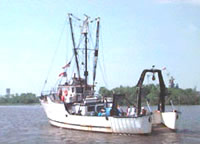 Dan Moore |
Barnhardt, W.A. (ed.), 2009, Coastal change along the shore of northeastern South Carolina—the South Carolina coastal erosion study: U.S. Geological Survey Circular 1339, 77 p., https://doi.org/10.3133/cir1339.
Montgomery, E., Sherwood, C., 2013, Studying seafloor bedforms using autonomous stationary imaging and profiling sonars: , OCEANS'13 MTS/IEEE Proceedings Paper. pp. 1–7 URL: http://ieeexplore.ieee.org/xpl/freeabs_all.jsp?arnumber=6741159&abstractAccess=no&userType=inst.
Barnhardt, W.A. (ed.), 2009, Coastal change along the shore of northeastern South Carolina—the South Carolina coastal erosion study: U.S. Geological Survey Open-File Report 2008-1206, URL: https://doi.org/10.3133/ofr20081206.
Sullivan, C.M., Warner, J.C., Martini, M.A., Voulgaris, G., Work, P.A., Haas, K.A., and Hanes, D., 2006, South Carolina coastal erosion study data report for observations October 2003 - April 2004: U.S. Geological Survey Open-File Report, https://doi.org/10.3133/ofr20051429.
| Survey Equipment | Survey Info | Data Type(s) | Data Collected |
|---|---|---|---|
| Mooring tripod | --- | Ground Truthing | |
| DGPS | --- | Navigation | |
| Temperature and salinity | --- | CTD Temperature | 2003-048-FA-OM-001 (Myrtle Beach mooring data) |
| Pressure | --- | Mooring (physical oceanography) | 2003-048-FA-OM-002 (Myrtle Beach mooring data) |
| Turbidity | --- | Mooring (physical oceanography) | 2003-048-FA-OM-003 (Myrtle Beach mooring data) |
| Current | --- | Mooring (physical oceanography) | 2003-048-FA-OM-004 (Myrtle Beach mooring data) |
