Other ID: MH46-04
Status: Completed
Organization(s): USGS, Woods Hole Coastal and Marine Science Center
Funding Program(s):
Principal Investigator(s): Michael Bothner
Affiliate Investigator(s): William Martin (WHOI)
Information Specialist(s): Michael Casso, Frances Lightsom
Data Type(s): Environmental Data: CTD, Environmental Data: Dissolved Oxygen, Environmental Data: Temperature, Geochemical: Experiments (geochemical), Imagery: Photo, Imagery: Video, Location-Elevation: Navigation, Sampling: Geology, Time Series: Mooring (physical oceanography)
Scientific Purpose/Goals: Exchanged long-term moorings at Station A off Boston. Collected 8 sediment cores. Deployed and recovered oxygen profiler. Deployed benthic chambers.
Vehicle(s):
Start Port/Location: U.S. Coast Guard Base, Boston, MA
End Port/Location: U.S. Coast Guard Base, Boston, MA
Start Date: 2004-09-22
End Date: 2004-09-23
Equipment Used: SBE 43 Dissolved Oxygen Sensor, Benthic Chambers, GPS (wh), Video camera - deep sea, Temperature and salinity, Pressure, Slow corer, Digital camera, Camera- deep sea, Current
Information to be Derived: Time series data; Samples and chemical analysis; Grain size analysis; Suspended sediment concentrations;
Summary of Activity and Data Gathered: Exchanged long-term moorings at Station A off Boston. Moorings deployed: 2 (#774 recovered adrift, FA 04065 CHRISTOPHER ANDREW Dec. 31, 2004; #775 recovered FA 05003 ABBIE BURGESS Feb. 5-6, 2005). Moorings recovered: 3 (#766, 767 with film, and 768, all deployed FA 04026 MARCUS HANNA May 19-20, 2004). Recovered 38 sediment trap samples. Collected 3 cores from Station 2 (sandy) and 5 cores from Station 3 (muddy).
Staff: Dann Blackwood, Jonathan Borden, Michael Bothner, Brian Buczkowski, Michael Casso, Dirk Koopmans, Richard Rendigs, Stephen Ruane
Affiliate Staff:
From WHOI: William Martin and Joanne Goudreau
Notes: Original Center People field contained: Dann Blackwood, Jonathan Borden, Mike Bothner, Brian Buczkowski, Michael Casso, Dirk Koopmans, Richard Rendigs, Stephen Ruane. All assisted in instrument deployment and recovery, and sample collection at sea.
Project = Massachusetts Bay Circulation and Contaminant Transport, Massachusetts Bay Circulation and Contaminant Transport
Location:
Massachusetts Bay, Massachusetts, United States, North America, North Atlantic,
| Boundaries | |||
|---|---|---|---|
| North: 42.5 | South: 42.25 | West: -70.91 | East: -70.58 |
Platform(s):
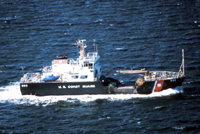 Abbie Burgess |
Bothner, M.H., and Butman, Bradford (eds.), 2007, Processes influencing the transport and fate of contaminated sediments in the coastal ocean—Boston Harbor and Massachusetts Bay: U.S. Geological Survey Circular 1302, 89 p., https://doi.org/10.3133/cir1302.
Bothner, M.H., Butman, B., and Casso, M.A., 2010, Review of oceanographic and geochemical data collected in Massachusetts Bay during a large discharge of total suspended solids from Boston’s sewage-treatment system and ocean outfall in August 2002: U.S. Geological Survey Open-File Report 2010–1050, 11 p., at https://doi.org/10.3133/ofr20101050.
Butman, B., Bothner, M.H., Alexander, P.S., Lightsom, F.L., Martini, M.A., Gutierrez, B.T., and Strahle, W.S., 2004, Long-term oceanographic observations in western Massachusetts Bay offshore of Boston, Massachusetts; data report for 1989-2002: U.S. Geological Survey Digital Data Series DDS-74, Version 2.0, DVD-ROM, URL: https://doi.org/10.3133/ds74_v2.
Butman, B., Dalyander, P.S., Bothner, M.H., Borden, J., Casso, M.A., Gutierrez, B.T., Hastings, M.E., Lightsom, F.L., Martini, M.A., Montgomery, E.T., Rendigs, R.R., and Strahle, W.S., 2009, Long-term oceanographic observations in Massachusetts Bay, 1989 - 2006 (version 3): U.S. Geological Survey Data Series 74, https://doi.org/10.3133/ds74.
Butman, B., Dalyander, P.S., Bothner, M.H., and Lange, W.N., 2008, Time-series photographs of the sea floor in western Massachusetts Bay, 1996 - 2005: U.S. Geological Survey Data Series 266, https://doi.org/10.3133/ds266.
| Survey Equipment | Survey Info | Data Type(s) | Data Collected |
|---|---|---|---|
| SBE 43 Dissolved Oxygen Sensor | --- | Dissolved Oxygen | |
| Benthic Chambers | --- | Experiments (geochemical) | |
| GPS (wh) | --- | Navigation | |
| Video camera - deep sea | --- | Video | |
| Temperature and salinity | --- | CTD Temperature | |
| Pressure | --- | Mooring (physical oceanography) | |
| Slow corer | --- | Geology | |
| Digital camera | --- | Photo | 2004-032-FA-PH-001 (Deck photos of field activity operations) |
| Camera- deep sea | --- | Photo | 2004-032-FA-PH-002 (film collection of TRIPOD 775; 20040922-20050209) |
| Current | --- | Mooring (physical oceanography) | 2004-032-FA-OM-001 (Western Mass Bay mooring data) |
