Other ID: S-W1-08-SC
Status: Completed
Organization(s): USGS, Woods Hole Coastal and Marine Science Center
Funding Program(s):
Principal Investigator(s): Christopher Sherwood
Affiliate Investigator(s): P. Wiberg - University of Virginia
Information Specialist(s): PARTNER, Christopher Sherwood
Data Type(s): Environmental Data: CTD, Environmental Data: Temperature, Imagery: Photo, Location-Elevation: Navigation, Sampling: Chemistry, Sampling: Geology, Time Series: Mooring (physical oceanography)
Scientific Purpose/Goals: Coring; recover equipment.
Vehicle(s):
Start Port/Location: SCMI, Terminal Island, San Pedro, CA
End Port/Location: SCMI, Terminal Island, San Pedro, CA
Start Date: 2008-02-27
End Date: 2008-02-28
Equipment Used: Sediment traps, GPS (wh), Temperature and salinity, Pressure, Turbidity, Digital camera, Slow corer, Water sampler, Current
Information to be Derived:
Summary of Activity and Data Gathered: 27 Feb, R/V SEA WATCH: Slow cores and CTDs with water samples at PV sites B3 and B5. 28 Feb, R/V SEA WATCH: Slow cores and CTDs with water samples at PV sites B2, B7, and B6. 28 Feb, R/V YELLOWFIN: Recover Geoprobe tripod at B3, USGS Mooring ID 842.
Staff: Jonathan Borden, Richard Rendigs, Christopher Sherwood
Affiliate Staff:
USGS-Santa Cruz: Joanne Ferreira; U. of Virginia: Pat Wiberg; UCLA: Maarten Buijsman
Notes: Data Curator: Kurt Rosenberger.
Project = California Urban Project - Environmental Protection Agency (EPA), California Urban Project - Environmental Protection Agency (EPA)
Location:
Palos Verdes, California, United States, North America, North Pacific;
| Boundaries | |||
|---|---|---|---|
| North: 33.73188 | South: 33.67605 | West: -118.359 | East: -118.29235 |
Platform(s):
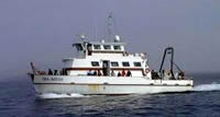 Sea Watch | 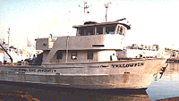 Yellowfin |
Wiberg, P.L., and Sherwood, Christopher R., 2008, Calculating wave-generated bottom orbital velocities from surface-wave parameters: Computers and Geosciences, v. 34 no. 10, doi: 10.1016/j.cageo.2008.02.010.
| Survey Equipment | Survey Info | Data Type(s) | Data Collected |
|---|---|---|---|
| Sediment traps | --- | Geology | |
| GPS (wh) | --- | Navigation | |
| Temperature and salinity | --- | CTD Temperature | |
| Pressure | --- | Mooring (physical oceanography) | |
| Turbidity | --- | Mooring (physical oceanography) | |
| Digital camera | --- | Photo | |
| Slow corer | --- | Geology | 2008-013-FA-SC-001 (10 samples from 5 slow-cores: see B. Buczkowski's Samples Archive database for additional information about individual samples.) 2008-013-FA-SC-001-01 (B. Buczkowski's Samples Archive database: 10 records, sample IDs B3-4, B7-1, B6-2, B2-2, and B5-3) |
| Water sampler | --- | Chemistry | 2008-013-FA-SC-002 (Water Samples: used for CTD calibrations.) |
| Current | --- | Mooring (physical oceanography) |
