Other ID: none
Status: Completed
Organization(s): USGS, Woods Hole Coastal and Marine Science Center
Funding Program(s):
Principal Investigator(s): Marinna Martini
Affiliate Investigator(s): Sandy Williams, WHOI
Information Specialist(s): Ellyn Montgomery
Data Type(s): Environmental Data: CTD, Environmental Data: Temperature, Imagery: Photo, Location-Elevation: Navigation, Time Series: Mooring (physical oceanography)
Scientific Purpose/Goals: Recover tripods 859 and 860; CTD casts.
Vehicle(s):
Start Port/Location: Woods Hole, MA
End Port/Location: Woods Hole, MA
Start Date: 2009-11-02
End Date: 2009-11-02
Equipment Used: Digital camera, DGPS, CTD 19+ with OBS, PAR, DO, Chl, GPS (wh), Bottom platform, Temperature and salinity, Pressure, Turbidity, Current
Information to be Derived: Time series data
Summary of Activity and Data Gathered: Fired releases on tripods at both USGS sites, but no floats were sighted on surface. Fired releases at WHOI tripod site, but no floats were sighted on surface. No tripods were recovered. Performed CTD casts. Tripods were actually recovered on Nov. 9 by divers (2009-076-FA).
Staff: Brandy Armstrong, Patrick Dickhudt, Marinna Martini, Ellyn Montgomery, Christopher Sherwood
Affiliate Staff:
Sandy Williams
WHOI
engineer
Notes: This activity is based on Field Activity 09063.
Project = Martha's Vineyard Coastal Observatory - Measurements and Modeling Applications, Martha's Vineyard Coastal Observatory - Measurements and Modeling Applications
Location:
Buzzards Bay, Massachusetts, United States, North America, North Atlantic;
| Boundaries | |||
|---|---|---|---|
| North: 41.69753 | South: 41.43861 | West: -70.8508 | East: -70.66956 |
Platform(s):
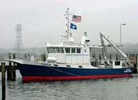
 Tioga |
Ganju, N.K., Dickhudt, P.J., Thomas, J.A., Borden, J., Sherwood, C.R., Montgomery, E.T., Twomey, E.R., and Martini, M.A., 2011, Summary of oceanographic and water-quality measurements in West Falmouth Harbor and Buzzards Bay, Massachusetts, 2009-2010: U.S. Geological Survey Open-File Report 2011-1113, https://doi.org/10.3133/ofr20111113.
| Survey Equipment | Survey Info | Data Type(s) | Data Collected |
|---|---|---|---|
| Digital camera | --- | Photo | |
| DGPS | --- | Navigation | |
| CTD 19+ with OBS, PAR, DO, Chl | --- | CTD | 2009-065-FA-GP-001-01 (all seabird data from this cruise (TI409)) |
| GPS (wh) | --- | Navigation | |
| Bottom platform | --- | Mooring (physical oceanography) | |
| Temperature and salinity | --- | CTD Temperature | |
| Pressure | --- | Mooring (physical oceanography) | |
| Turbidity | --- | Mooring (physical oceanography) | |
| Current | --- | Mooring (physical oceanography) |