Other ID: none
Status: Completed
Organization(s): USGS, Woods Hole Coastal and Marine Science Center
Funding Program(s):
Principal Investigator(s): John Warner
Affiliate Investigator(s): Kevin Haas, Georgia Institute of Technology; George Voulgaris, University of South Carolina; Jesse McNinch, Army Corps of Engineers; Jeff Book, Naval Research Laboratory
Information Specialist(s): Brandy Armstrong
Data Type(s): Environmental Data: CTD, Environmental Data: Temperature, Imagery: Photo, Imagery: Video, Location-Elevation: Navigation, Sampling: Geology, Sonar: Single Beam, Time Series: Mooring (physical oceanography)
Scientific Purpose/Goals: Observe coastal change in the near shore area of Cape Hatteras.
Vehicle(s):
Start Port/Location: Buxton, NC
End Port/Location: Buxton, NC
Start Date: 2010-01-28
End Date: 2010-03-01
Equipment Used: Digital video camera, Digital camera, Grab sampler, Current, Echosounder, Real Time Kinematic GPS, SCUBA, Temperature and salinity, Pressure
Information to be Derived:
Summary of Activity and Data Gathered: Time series instrumentation was deployed at 14 sites in the nearshore area, a video camera was mounted on the lighthouse, a coastal radar was installed on the beach. Targets for aerial surveys were installed on the beach.
Staff: Brandy Armstrong, Sandy Baldwin, Dann Blackwood, Jonathan Borden, Michael Casso, Jeffrey List, Marinna Martini, E. Robert Thieler, John Warner, Charles Worley
Affiliate Staff:
Ray Townsend
Brian Scarborough
USCAE; B.J. Reynolds
Jordan Sanford
USGS-St. Petersburg;
Nirnemesh Kumar
Jeff Morin
USC; Paul Gay
? Sapp
Stephanie Smalligan
? Yang
Georgia Tech; ? NRL
Notes: Amount of continuous data is a guess, Hypack position and bathymetry was recorded for some transects during the course of the experiment.
Project = Carolinas: Sediment Transport, Carolinas: Sediment Transport
Location:
Cape Hatteras, North Carolina, United States, North America, North Atlantic,
| Boundaries | |||
|---|---|---|---|
| North: 35.26071 | South: 35.21412 | West: -75.6068 | East: -75.49337 |
Platform(s):
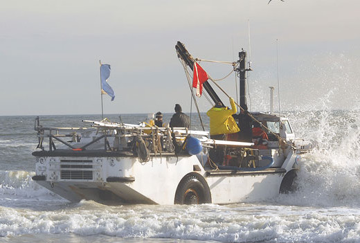 LARC |
Armstrong, B.N., Warner, J.C., Voulgaris, G., List, J.H., Thieler, E.R., Martini, M.A., Montgomery, E., McNinch, J., Book, J.W., and Haas, K., 2013, Carolinas Coastal Change Processes Project data report for nearshore observations at Cape Hatteras, North Carolina, February 2010: U.S. Geological Survey Open-File Report 2012–1219, https://doi.org/10.3133/ofr20121219.
Kumar, N., Voulgaris, G., Warner, J.C., and List, J.H., 2012, Wind and Wave Driven Nearshore Circulation at Cape Hatteras Point [abs.]: , 2012 AGU Fall Meeting. San Francisco, CA, December 3-7, 2012.
Safak, I., List, J., Warner, J., 2014, Physical and geological controls on long-term sediment transport patterns along a wave-energetic, non-interrupted coastline: Oregon Inlet to Cape Hatteras [abs.]: , AGU Ocean Science Meeting. Honolulu, HI, February 23-28, 2014.
| Survey Equipment | Survey Info | Data Type(s) | Data Collected |
|---|---|---|---|
| Digital video camera | --- | Video | |
| Digital camera | --- | Photo | |
| Grab sampler | --- | Biology Geology | |
| Current | --- | Mooring (physical oceanography) | 2010-011-FA-NL-001 (Paper Mooring Log Sheets: data recorded by techs and observers during the deployment activities for moorings 864 through 880) 2010-011-FA-NL-001-01 (Raw and Engineering records for moorings 864-880, Cape Hatteras 2009 and 2010.) 2010-011-FA-OM-001-01 (All Data from moorings 864-880: part of Cape Hatteras Nearshore experiment) |
| Echosounder | --- | Single Beam | |
| Real Time Kinematic GPS | --- | Navigation | |
| SCUBA | --- | Biology Chemistry Geology | |
| Temperature and salinity | --- | CTD Temperature | |
| Pressure | --- | Mooring (physical oceanography) |
