Other ID: none
Status: Completed
Organization(s): USGS, Woods Hole Coastal and Marine Science Center
Funding Program(s):
Principal Investigator(s): Neil Kamal Ganju
Affiliate Investigator(s):
Information Specialist(s): Neil Kamal Ganju
Data Type(s): Visual Identification: Ground Truthing
Scientific Purpose/Goals: Check depths in West Falmouth Harbor.
Vehicle(s):
Start Port/Location: Town Dock, West Falmouth
End Port/Location: Town Dock, West Falmouth
Start Date: 2010-05-07
End Date: 2010-05-07
Equipment Used: Reconnaissance
Information to be Derived:
Summary of Activity and Data Gathered: Took soundings with weight in Mashapaquit Creek; recorded channel conditions.
Staff: Jonathan Borden, Patrick Dickhudt
Affiliate Staff:
Notes:
Location:
Buzzards Bay, Cape Cod, Massachusetts, United States, North America, North Atlantic,
| Boundaries | |||
|---|---|---|---|
| North: 41.61005 | South: 41.59503 | West: -70.6519 | East: -70.63522 |
Platform(s):
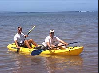 Kayak |
Ganju, N.K., Dickhudt, P.J., Thomas, J.A., Borden, J., Sherwood, C.R., Montgomery, E.T., Twomey, E.R., and Martini, M.A., 2011, Summary of oceanographic and water-quality measurements in West Falmouth Harbor and Buzzards Bay, Massachusetts, 2009-2010: U.S. Geological Survey Open-File Report 2011-1113, https://doi.org/10.3133/ofr20111113.
| Survey Equipment | Survey Info | Data Type(s) | Data Collected |
|---|---|---|---|
| Reconnaissance | --- | Ground Truthing | 2010-037-FA-NL-001 (one page of sketches) |
