Other ID: none
Status: Completed
Organization(s): USGS, Woods Hole Coastal and Marine Science Center
Funding Program(s): Other (Other)
Principal Investigator(s): John Warner
Affiliate Investigator(s):
Information Specialist(s): Brandy Armstrong
Data Type(s): Environmental Data: CTD, Environmental Data: Meteorology, Environmental Data: Temperature, Imagery: Photo, Imagery: Video, Location-Elevation: Navigation, Sampling: Geology, Sonar: Single Beam, Time Series: Mooring (physical oceanography)
Scientific Purpose/Goals: Recover moorings 919 - 933
Vehicle(s):
Start Port/Location: Woods Hole, MA
End Port/Location: Woods Hole, MA
Start Date: 2012-04-16
End Date: 2012-04-20
Equipment Used: SeaBOSS, Digital camera, Sensors - other mooring, Echosounder, Bottom platform, HYPACK, Current, Pressure, Temperature and salinity, Turbidity, DGPS
Information to be Derived: Time series data;
Summary of Activity and Data Gathered: Six moorings and nine tripods successfully recovered without incident.
Staff: Brandy Armstrong, Sandy Baldwin, Dann Blackwood, Jonathan Borden, Erika Lentz, Marinna Martini, Jeffrey Obelcz
Affiliate Staff:
Notes: Project = Long Island Barrier Island,
Location:
Fire Island, New York, USA
| Boundaries | |||
|---|---|---|---|
| North: 40.65251 | South: 40.61187 | West: -73.287 | East: -73.15796 |
Platform(s):
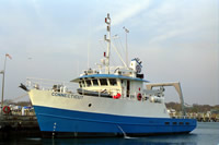
 Connecticut |
Montgomery, E., Sherwood, C., 2013, Studying seafloor bedforms using autonomous stationary imaging and profiling sonars: , OCEANS'13 MTS/IEEE Proceedings Paper. pp. 1–7 URL: http://ieeexplore.ieee.org/xpl/freeabs_all.jsp?arnumber=6741159&abstractAccess=no&userType=inst.
| Survey Equipment | Survey Info | Data Type(s) | Data Collected |
|---|---|---|---|
| SeaBOSS | --- | Surveys (biological) Experiments (biological) Species ID Photo Video Geology Biology | |
| Digital camera | --- | Photo | 2012-014-FA-PH-001 (Photos taken during preparation, deployment and recovery. ) |
| Sensors - other mooring | --- | CTD Meteorology Temperature Mooring (physical oceanography) | |
| Echosounder | --- | Single Beam | |
| Bottom platform | --- | Mooring (physical oceanography) | 2012-014-FA-OM-001-01 (Hydra data: Point velocity, velocity profiles, pressure, salinity, temperature, acoustic backscatter, optical backscatter and transmissivity ) 2012-014-FA-SO-001-01 (Pencil and Fanbeam data for mooring 924) |
| HYPACK | --- | Navigation | |
| Current | --- | Mooring (physical oceanography) | 2012-014-FA-OM-002-01 (ADCP and AWAC velocity profiles and wave data) |
| Pressure | --- | Mooring (physical oceanography) | |
| Temperature and salinity | --- | CTD Temperature | 2012-014-FA-OM-003-01 ( Microcat and Seacat data: Salinity, temperature and pressure) |
| Turbidity | --- | Mooring (physical oceanography) | |
| DGPS | --- | Navigation |