Other ID: none
Status: Completed
Organization(s): USGS, Woods Hole Coastal and Marine Science Center
Funding Program(s):
Principal Investigator(s): Patrick Dickhudt, Christopher Sherwood
Affiliate Investigator(s): Chris Smith, USGS St. Petersburg
Information Specialist(s): Patrick Dickhudt
Data Type(s): Imagery: Photo, Location-Elevation: Navigation, Time Series: Mooring (physical oceanography)
Scientific Purpose/Goals: Install water-level recorders on Chandeleur Islands
Vehicle(s):
Start Port/Location: Biloxi, MS
End Port/Location: Biloxi, MS
Start Date: 2012-07-09
End Date: 2012-07-13
Equipment Used: Digital camera, DGPS, Pressure
Information to be Derived: Time series data;Grain size analysis;
Summary of Activity and Data Gathered: Chandeleur Islands berm studies. Deployed four buried pressure sensors in shallow wells, and one atmos. pressure sensor on radio tower. Took photos surface sediment samples at four wellsites.
Staff: Patrick Dickhudt
Affiliate Staff:
Nancy Dewitt
USGS St. Pete
Chris Reich
USGS St. Pete
Kyle Kelso
USGS St. Pete
Notes: Project = BERM/Chandeleur Study, BERM/Chandeleur Study
Location:
Gulf of America (Gulf of Mexico), North America, North Atlantic;, Chandeleur Islands
| Boundaries | |||
|---|---|---|---|
| North: 30.09761 | South: 29.78345 | West: -88.9948 | East: -88.67065 |
Platform(s):
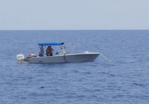
 Halimeda |
Dickhudt,P.J., Sherwood, C.R., and Dewitt, N.T., 2015, Water-level and wave measurements in the Chandeleur Islands, Louisiana, 2012 and 2013: U.S. Geological Survey Open-File Report, https://doi.org/10.3133/ofr20141246.
| Survey Equipment | Survey Info | Data Type(s) | Data Collected |
|---|---|---|---|
| Digital camera | --- | Photo | |
| DGPS | --- | Navigation | |
| Pressure | --- | Mooring (physical oceanography) | data from 2012-026-FA (All data from Chandeleur Island BIER program) |