Other ID: none
Status: Completed
Organization(s): USGS, St. Petersburg Coastal and Marine Science Center
Funding Program(s): Other (Other)
Principal Investigator(s): Lisa Osterman
Affiliate Investigator(s):
Information Specialist(s): Dana Wiese
Data Type(s): Seismics: Sub Bottom Profiler
Scientific Purpose/Goals: investigate paleo oceanography of gulf of mexico, Holocen history
Vehicle(s):
Start Port/Location: Lumcon, LA
End Port/Location: Lumcon, LA
Start Date: 2002-07-28
End Date: 2002-07-29
Equipment Used: Chirp 424
Information to be Derived: Geophysical data
Summary of Activity and Data Gathered: Chirp
Staff: Lisa Osterman, Dana Wiese
Affiliate Staff:
Notes: UTM zone 15- using ships nav into hypack; Water depth makes record unreadable @ times (too much water column)
Location:
Louisiana, Offshore
| Boundaries | |||
|---|---|---|---|
| North: 30 | South: 28 | West: -91.5 | East: -89.15 |
Platform(s):
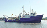 Pelican |
| Survey Equipment | Survey Info | Data Type(s) | Data Collected |
|---|---|---|---|
| Chirp 424 | --- | Sub Bottom Profiler |
