Other ID: none
Status: Completed
Organization(s): USGS, St. Petersburg Coastal and Marine Science Center
Funding Program(s): National Assessment of Coastal Change Hazards - NACCH (GX.21.MN00.F4J20.00)
Data Source Information: Digital Coast /FEMA
Information Specialist(s): Kara Doran
Data Type(s): Location-Elevation: LIDAR
Start Date: 2003-10-21
End Date: 2003-12-07
Equipment Used: Light Detection and Ranging (Lidar)
Information to be Derived: Beach morphology
Summary of Activity and Data Gathered: Horizons Inc. was contracted by EarthData International to collect ALS-40 Lidar data over the coastal area of Oahu, Hawaii. The project site was flown on October 21 and November 1, 8, 24, 27, and December 7, 2003, using aircraft 2636P. Lidar data was captured using an ALS-40 Lidar system, including an inertial measuring unit (IMU) and a dual frequency GPS receiver.
Notes:
Location:
Oahu
| Boundaries | |||
|---|---|---|---|
| North: 21.7284 | South: 21.25025 | West: -157.64879 | East: -158.282 |
Platform(s):
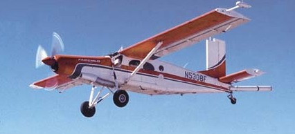 Airplane |
Doran, K.S., Long, J.W., Birchler, J.J., Brenner, O.T., Hardy, M.W., Morgan, K.L.M., Stockdon, H.F., Torres, M.L., 2018, Lidar-derived beach morphology (Dune Crest, Dune Toe, and Shoreline) for U.S. sandy coastlines (ver 2.0, August 2018): U.S. Geological Survey data release, https://doi.org/10.5066/F7GF0S0Z.
Long, J.W., Henderson, R.E., Thompson, D.M., 2020, Forecasting future beach width-A case study along the Florida Atlantic coast: U.S. Geological Survey Open-File Report 2019-1150, 20 p., https://doi.org/10.3133/ofr20191150.
Stockdon, H.F., Long, J.W., Palmsten, M.L., Van der Westhuysen, A., Doran, K.S., Snell, R.J., 2023, Operational forecasts of wave-driven water levels and coastal hazards for US Gulf and Atlantic coasts: Communications Earth & Environment, v. 4 no. 1, 169 p., doi: 10.1038/s43247-023-00817-2.
| Survey Equipment | Survey Info | Data Type(s) | Data Collected |
|---|---|---|---|
| Light Detection and Ranging (Lidar) | --- | LIDAR | 03CNT04_morphology.zip (Dune crest, dune toe, shoreline, beach width and beach slope for a lidar survey collected 20031021 in Hawai‘i) 03CNT04_lidar_all (2003 Oahu Coastline Lidar, published on digital coast) |