Other ID: ATRIS/2007/FL_REEFS/
Status: Completed
Organization(s): USGS, St. Petersburg Coastal and Marine Science Center
Funding Program(s):
Principal Investigator(s): John Brock, Amar Nayegandhi
Affiliate Investigator(s):
Information Specialist(s):
Data Type(s): Imagery: Photo, Location-Elevation: Navigation, Sonar: Single Beam
Scientific Purpose/Goals: Obtain high-resolution geo-located imagery and submerged topography to understand benthic habitat and structure
Vehicle(s):
Start Port/Location: (Florida City) Florida
End Port/Location: (Florida City) Florida
Start Date: 2007-09-10
End Date: 2007-09-21
Equipment Used: Single-beam Acoustic Sounder, GPS , Along Track Reef Imaging System (ATRIS) - Shallow
Information to be Derived: Geo-located imagery, submerged topography
Summary of Activity and Data Gathered: Boat based acoustic data and imagery
Staff: William (Jerry) Butcher, Emily Klipp, Keith Ludwig, Monica Palaseanu-Lovejoy, Philip Thompson
Affiliate Staff:
Notes: Platform: Grady White, ATRIS
Location:
Northern FLorida Keys
| Boundaries | |||
|---|---|---|---|
| North: 25.42418943 | South: 24.48402299 | West: -81.3414 | East: -80.05592682 |
Platform(s):
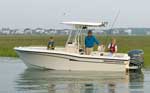 Grady-White |
| Survey Equipment | Survey Info | Data Type(s) | Data Collected |
|---|---|---|---|
| Single-beam Acoustic Sounder | --- | Single Beam | |
| GPS | --- | Navigation | |
| Along Track Reef Imaging System (ATRIS) - Shallow | --- | Surveys (biological) Photo Video Navigation Profiles |
