Other ID: Frog Creek Bathymetry Survey
Status: Completed
Organization(s): USGS, St. Petersburg Coastal and Marine Science Center
Funding Program(s):
Principal Investigator(s): Cliff Hearn
Affiliate Investigator(s):
Information Specialist(s): Billy Reynolds
Data Type(s): Location-Elevation: Navigation, Sonar: Single Beam, Time Series: Mooring (physical oceanography)
Scientific Purpose/Goals: To provide bathymetry of Frog Creek a freshwater tributary into Tampa Bay that will enhance the Tampa Bay Model Circulation Model construction
Vehicle(s):
Start Port/Location: Frog Creek Landing, Tampa Bay
End Port/Location: Frog Creek Landing, Tampa Bay
Start Date: 2007-01-08
End Date: 2007-04-05
Equipment Used: Choke Ring Antenna, Tripod, Marimatech Echosounder, Ashtech Z-Xtreme DGPS
Information to be Derived: High precision single beam bathymetry (X, Y, Z) data; purpose being to acquire the latest bathymetry to provide creek basin morphology to supplement the Tampa Bay Circulation Model
Summary of Activity and Data Gathered: Surveyed over 7 kilometers of tracklines; Collected 3 days of static base station occupation time on National Geodetic Survey (NGS) benchmarks
Staff: Billy Reynolds
Affiliate Staff:
Notes:
Location:
Tampa Bay, FL
| Boundaries | |||
|---|---|---|---|
| North: 27.88854972 | South: 27.59328973 | West: -82.6989 | East: -82.33217999 |
Platform(s):
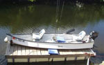 Gheenoe |
| Survey Equipment | Survey Info | Data Type(s) | Data Collected |
|---|---|---|---|
| Choke Ring Antenna | --- | Benchmarks Navigation | No data was collected |
| Tripod | --- | Mooring (physical oceanography) Benchmarks Navigation | No data was collected |
| Marimatech Echosounder | --- | Single Beam | |
| Ashtech Z-Xtreme DGPS | --- | Benchmarks Navigation |
