Other ID: none
Status: Completed
Organization(s): USGS, St. Petersburg Coastal and Marine Science Center
Funding Program(s):
Principal Investigator(s): James Flocks
Affiliate Investigator(s):
Information Specialist(s): Nancy DeWitt
Data Type(s): Location-Elevation: Navigation, Location-Elevation: Profiles, Location-Elevation: Transects, Sonar: Single Beam
Scientific Purpose/Goals: Barrier Island Coastal Monitoring
Vehicle(s):
Start Port/Location: Cameron, Louisiana
End Port/Location: Cameron, Louisiana
Start Date: 2007-07-17
End Date: 2007-07-26
Equipment Used: TSS DMS-05 Motion Sensor, Ashtech Z-Xtreme DGPS, Marimatech Echosounder
Information to be Derived: Single beam bathymetry (X, Y, Z) data; purpose being to acquire the latest bathymetry to assist in calculating sediment gain/loss and barrier island migration or degradation
Summary of Activity and Data Gathered: Surveyed more than 511 kilometers of tracklines; Collected 10 days of static base station occupation time on U.S. Geological Survey-Florida Integrated Science Center (USGS-FISC) installed benchmarks and National Geodetic Survey (NGS) benchmarks
Staff: Nancy DeWitt, Billy Reynolds
Affiliate Staff:
Notes:
Location:
Cheniere Plain, LA
| Boundaries | |||
|---|---|---|---|
| North: 29.855136 | South: 29.16692271 | West: -94.481 | East: -90.89943252 |
Platform(s):
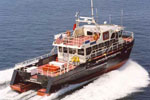 Survey Cat (Class 3) |
| Survey Equipment | Survey Info | Data Type(s) | Data Collected |
|---|---|---|---|
| TSS DMS-05 Motion Sensor | --- | Interferometric Single Beam | No data was collected |
| Ashtech Z-Xtreme DGPS | --- | Benchmarks Navigation | |
| Marimatech Echosounder | --- | Single Beam |
