Other ID: none
Status: Completed
Organization(s): USGS, St. Petersburg Coastal and Marine Science Center
Funding Program(s):
Principal Investigator(s): James Flocks
Affiliate Investigator(s):
Information Specialist(s):
Data Type(s): Biological Field Study: Experiments (biological), Biological Field Study: Surveys (biological), Location-Elevation: Navigation, Sampling: Geology
Scientific Purpose/Goals: Characterization of the geological framework, mapping sediment distribution, and dispersal of sediment after a major hurricane.
Vehicle(s):
Start Port/Location: Venice, Louisiana
End Port/Location: Biloxi, Mississippi
Start Date: 2007-06-15
End Date: 2007-06-26
Equipment Used: Vibracorer, GPS
Information to be Derived: Grain-size, photographs, interpreted core profiles, and barrier island assessment report to Fish and Wildlife. (* Report in progress)
Summary of Activity and Data Gathered: Offshore of Chandeleur Islands a total of 83 cores were collected. Offshore of Breton Island a total of 7 cores were collected. Summary and evaluation of data are referenced in a U.S. Geological Survey Data Series. (*Data Series in progress)
Staff: Julie Bernier, Keith Ludwig, Jordan Sanford
Affiliate Staff:
Notes: Additional Equipment: 3"x 20' pipe, Chandeleur Island House Boat Equipment Model: Bradford Pneumatic Vibracore
Location:
Chandeleur Islands, LA, Northern Gulf of Mexico
| Boundaries | |||
|---|---|---|---|
| North: 30.60784383 | South: 28.94117716 | West: -89.6236 | East: -86.4628352 |
Platform(s):
 G.K. Gilbert | 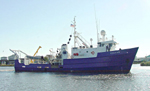 Pelican |
Dreher, C., Flocks, J.G., Kulp, M.A., Ferina, N.F., 2010, Archive of sediment data collected from offshore Chandeleur Islands and Breton Island in 2007 and 1987 (vibracore surveys: 07SCC04, 07SCC05, and 87039): U.S. Geological Survey Data Series 542, https://doi.org/10.3133/ds542.
| Survey Equipment | Survey Info | Data Type(s) | Data Collected |
|---|---|---|---|
| Vibracorer | --- | Geology | 07SCC04-SA-pd-5 (digitizing methods) 07SCC04-SA-rd-1 (90 vibracores) 07SCC04-SA-pd-4 (core photographs) 07SCC04-SA-pd-2 (digitized core logs) 07SCC04-SA-pd-1 (core description sheets) 07SCC04-SA-pd-6 (Data Series 542 GIS dataset) 07SCC04-SA-pd-3 (grain size analyses) |
| GPS | --- | Navigation | 07SCC04-NL-rd-1 (Raw latitude and longitude coordinates for each core) |
