Other ID: SI WBPSP OFA/ 09BBT01
Status: Completed
Organization(s): USGS, St. Petersburg Coastal and Marine Science Center, Waccasassa Bay Preserve State Park
Funding Program(s):
Principal Investigator(s): Ellen Raabe
Affiliate Investigator(s):
Information Specialist(s): Ellen Raabe
Data Type(s): Environmental Data: pH, Imagery: Photo, Location-Elevation: Navigation
Scientific Purpose/Goals: Positive identification of discharge sites and flow estimates
Vehicle(s):
Start Port/Location: Cedar Key - WBP Park Office
End Port/Location: Cedar Key - WBP Park Office
Start Date: 2009-01-12
End Date: 2009-09-30
Equipment Used: pH Probe, Camera, Digital, Hand Held, Digital Camera, Global Positioning System (GPS)
Information to be Derived: Site description, flow estimate, initial water quality (planned only)
Summary of Activity and Data Gathered: Site reconnaissance and ground truth, verified by GPS, photographed, and visually evaluated, but flow was insufficient during prolonged drought to obtain flow measurements.
Staff: Ellen Raabe
Affiliate Staff:
Notes: Field data - flow not collected, Vehicle/access - State 4WD vehicles and airboat then hiking access to most locations. Center vehicle to Levy Co. id unknown. Other equipment = YSI meter for basic WQ measurements.
Location:
Waccasassa Bay , FL
| Boundaries | |||
|---|---|---|---|
| North: 29.2198639 | South: 29.00046849 | West: -83.13011169 | East: -82.7206 |
Platform(s):
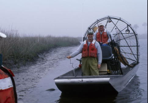 Airboat |
Raabe, E.A., Bialkowska-Jelinska, E., 2010, Thermal imaging of the Waccasassa Bay Preserve: Image acquisition and processing: U.S. Geological Survey Open-File Report 2010-1120, 69 p., https://doi.org/10.3133/ofr20101120.
| Survey Equipment | Survey Info | Data Type(s) | Data Collected |
|---|---|---|---|
| pH Probe | --- | pH | |
| Camera, Digital, Hand Held | --- | Photo | |
| Digital Camera | --- | Photo Video | |
| Global Positioning System (GPS) | --- | Navigation |
