Other ID: none
Status: Completed
Organization(s): USGS, St. Petersburg Coastal and Marine Science Center
Funding Program(s):
Principal Investigator(s):
Affiliate Investigator(s):
Information Specialist(s): Christopher Reich
Data Type(s): Imagery: Photo, Location-Elevation: Navigation, Sampling: Geology
Scientific Purpose/Goals: Bathymetry was collected in 2009 and peak intensity of bottom reflection provides an indication of benthic habitat type. Verification and ground truthing is needed to type the benthic composition and allow for cross-correlation with the bathymetric intensity.
Vehicle(s):
Start Port/Location: Biloxi, MS
End Port/Location: Biloxi, MS
Start Date: 2010-03-17
End Date: 2010-03-24
Equipment Used: Digital Camera, Global Positioning System (GPS), Grab Sampler
Information to be Derived: Classification and verification of bottom type in order to create/confirm benthic habitats
Summary of Activity and Data Gathered:
Staff:
Affiliate Staff:
Notes: Additional Equipment: Ponar grab sample.
Location:
Horn Island, MS to Petit Bois Island, MS
| Boundaries | |||
|---|---|---|---|
| North: 30.47991057 | South: 29.9665603 | West: -89.647 | East: -88.47145434 |
Platform(s):
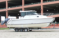 Glacier Bay Cat Boat |
Lavoie, D.L., Flocks, J., Twichell, D., Rose, K.V., 2013, Benthic substrate classification map: Gulf Islands National Seashore: U.S. Geological Survey Open-File Report 2012-1051, 14 p., https://doi.org/10.3133/ofr20121051.
| Survey Equipment | Survey Info | Data Type(s) | Data Collected |
|---|---|---|---|
| Digital Camera | --- | Photo Video | |
| Global Positioning System (GPS) | --- | Navigation | 10BHM01-NL-pd-1 (Shapefile of sample locations) |
| Grab Sampler | --- | Biology Geology |
