Other ID: none
Status: Completed
Organization(s): USGS, St. Petersburg Coastal and Marine Science Center
Funding Program(s):
Principal Investigator(s): Julie Bernier
Affiliate Investigator(s):
Information Specialist(s): Julie Bernier
Data Type(s): Location-Elevation: Navigation, Sampling: Geology
Scientific Purpose/Goals: Quantify accommodation-space formation, subsidence, and erosion in areas of historic wetland loss
Vehicle(s):
Start Port/Location: Sulphur, LA
End Port/Location: Sulphur, LA
Start Date: 2010-08-02
End Date: 2010-08-15
Equipment Used: Choke Ring Antenna, Ashtech Z-Xtreme DGPS, Push Corer
Information to be Derived: - GPS sediment-surface elevations will be used to estimate one-dimensional and three-dimensional accommodation space formed by historic wetland loss, - Stratigraphic analysis will be used to estimate the magnitude and rate of subsidence and erosion betwee
Summary of Activity and Data Gathered:
Staff: Julie Bernier, Nancy DeWitt, Gary Hill, Kyle Kelso
Affiliate Staff:
Notes: Shop Time: Dave Wegener built a mount to attach the GPS antenna to the airboat
Location:
Sabine National Wildlife Refuge, LA
| Boundaries | |||
|---|---|---|---|
| North: 29.95938816 | South: 29.82960543 | West: -93.6116 | East: -93.41354435 |
Platform(s):
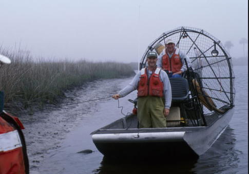 Airboat |
Bernier, J.C., 2017, Elevation data collected in 2010 from Sabine National Wildlife Refuge, Louisiana: U.S. Geological Survey data release, https://doi.org/10.5066/F7BR8QBH.
Bernier, J.C., 2013, Trends and causes of historical wetland loss in coastal Louisiana: U.S. Geological Survey Fact Sheet 2013-317, https://doi.org/10.3133/fs20133017.
Bernier, J.C., Morton, R.A., Kelso, K.W., 2011, Trends and causes of historical wetland loss, Sabine National Wildlife Refuge, southwest Louisiana: U.S. Geological Survey Open-File Report 2011-1169, 36 p., https://doi.org/10.3133/ofr20111169.
| Survey Equipment | Survey Info | Data Type(s) | Data Collected |
|---|---|---|---|
| Choke Ring Antenna | --- | Benchmarks Navigation | No data was collected |
| Ashtech Z-Xtreme DGPS | --- | Benchmarks Navigation | snwr_elev2010 (DGPS point elevation data) |
| Push Corer | --- | Geology | 10SWL01-SA-rd-1 (Push cores) OFR_2011-1169_AppA_all_sects (core description sheets) |
