Other ID: none
Status: Completed
Organization(s): USGS, St. Petersburg Coastal and Marine Science Center
Funding Program(s):
Principal Investigator(s): Mark Erik Hansen
Affiliate Investigator(s):
Information Specialist(s): Billy Reynolds
Data Type(s): Location-Elevation: Navigation, Location-Elevation: Profiles, Location-Elevation: Transects, Sonar: Single Beam
Scientific Purpose/Goals: To make a complete bathymetric map of Lemon Bay for bathymetry and benthic purposes
Vehicle(s):
Start Port/Location: Saint Petersburg, FL
End Port/Location: Saint Petersburg, FL
Start Date: 2011-07-05
End Date: 2011-07-08
Equipment Used: Choke Ring Antenna, Ashtech Z-Xtreme DGPS, Marimatech Echosounder, TSS DMS-05 Motion Sensor
Information to be Derived: High precision bathymetric data
Summary of Activity and Data Gathered: Single beam lines (#), single beam coverage (#km)
Staff: Nancy DeWitt, Kyle Kelso, Billy Reynolds
Affiliate Staff:
Notes: Equipment Used: Batteries, Laptop
Location:
Lemon Bay, Florida
| Boundaries | |||
|---|---|---|---|
| North: 26.96918049 | South: 26.93665924 | West: -82.3981 | East: -82.34786627 |
Platform(s):
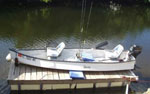 Gheenoe |  Personal Water Craft (White WVR1 - Shark) |
| Survey Equipment | Survey Info | Data Type(s) | Data Collected |
|---|---|---|---|
| Choke Ring Antenna | --- | Benchmarks Navigation | No data was collected |
| Ashtech Z-Xtreme DGPS | --- | Benchmarks Navigation | |
| Marimatech Echosounder | --- | Single Beam | DS1031-LemonBay_WGS84_NAVD88-G03_SB_shp.xyz.zip (Singlebeam soundings in Esri point shapefile format.) DS1031-LemonBay_WGS84_NAVD88-G03_SB_txt.xyz.zip (Singlebeam soundings in comma-delimited text format.) DS1031-LemonB_WGS84_NAVD88-G03.grid.zip (Bathymetric grid in Esri ASCII grid format.) |
| TSS DMS-05 Motion Sensor | --- | Interferometric Single Beam | No data was collected |
