Other ID: none
Status: Completed
Organization(s): USGS, St. Petersburg Coastal and Marine Science Center
Funding Program(s):
Principal Investigator(s): David Zawada
Affiliate Investigator(s):
Information Specialist(s): David Zawada
Data Type(s): Biological Field Study: Surveys (biological), Imagery: Photo, Imagery: Video, Location-Elevation: Navigation
Scientific Purpose/Goals: To collect baseline images for benthic habitat map construction
Vehicle(s):
Start Port/Location: Key West
End Port/Location: Key West
Start Date: 2011-07-10
End Date: 2011-07-23
Equipment Used: Along Track Reef Imaging System (ATRIS) - Shallow, Digital Camera
Information to be Derived: Images of the seafloor
Summary of Activity and Data Gathered:
Staff: Christina Kellogg, Christopher Reich, Philip Thompson
Affiliate Staff:
Notes: Additional Equipment Used: Laptop
Location:
Dry Tortugas National Park (DRTO)
| Boundaries | |||
|---|---|---|---|
| North: 24.65806825 | South: 24.5781303 | West: -82.9439 | East: -82.74856628 |
Platform(s):
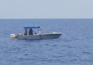
 Halimeda |
Zawada, D.G., Reich, C.D., Resnick, J.P., 2018, Shallow ATRIS (sATRIS) imagesâDry Tortugas National Park, Florida, 2011: U.S. Geological Survey data release, https://doi.org/10.5066/F7862DND.
| Survey Equipment | Survey Info | Data Type(s) | Data Collected |
|---|---|---|---|
| Along Track Reef Imaging System (ATRIS) - Shallow | --- | Surveys (biological) Photo Video Navigation Profiles | |
| Digital Camera | --- | Photo Video | DRTO2011_ATRIS_track1.zip (JPEG images with EXIF headers collected using shallow ATRIS from Dry Tortugas, Florida for track 1) DRTO2011_ATRIS_track3.zip (JPEG images with EXIF headers collected using shallow ATRIS from Dry Tortugas, Florida for track 3 ) DRTO2011_ATRIS_track6.zip (JPEG images with EXIF headers collected using shallow ATRIS from Dry Tortugas, Florida for track 6) DRTO2011_ATRIS_track5.zip (JPEG images with EXIF headers collected using shallow ATRIS from Dry Tortugas, Florida for track 5) DRTO2011_ATRIS_track13.zip (JPEG images with EXIF headers collected using shallow ATRIS from Dry Tortugas, Florida for track 13) DRTO2011_ATRIS_track10.zip (JPEG images with EXIF headers collected using shallow ATRIS from Dry Tortugas, Florida for track 10) DRTO2011_ATRIS_track8.zip (JPEG images with EXIF headers collected using shallow ATRIS from Dry Tortugas, Florida for track 8) DRTO2011_ATRIS_track14.zip (JPEG images with EXIF headers collected using shallow ATRIS from Dry Tortugas, Florida for track 14) DRTO2011_ATRIS_track7.zip (JPEG images with EXIF headers collected using shallow ATRIS from Dry Tortugas, Florida for track 7) DRTO2011_ATRIS_track9.zip (JPEG images with EXIF headers collected using shallow ATRIS from Dry Tortugas, Florida for track 9) DRTO2011_ATRIS_track11.zip (JPEG images with EXIF headers collected using shallow ATRIS from Dry Tortugas, Florida for track 11) DRTO2011_ATRIS_track4.zip (JPEG images with EXIF headers collected using shallow ATRIS from Dry Tortugas, Florida for track 4) DRTO2011_ATRIS_track12.zip (JPEG images with EXIF headers collected using shallow ATRIS from Dry Tortugas, Florida for track 12 ) DRTO2011_ATRIS_track2.zip (JPEG images with EXIF headers collected using shallow ATRIS from Dry Tortugas, Florida for track 2) |