Other ID: none
Status: Completed
Organization(s): USGS, St. Petersburg Coastal and Marine Science Center, USGS, Alabama Water Resources
Funding Program(s):
Principal Investigator(s): Athena Clark
Affiliate Investigator(s):
Information Specialist(s): Dana Wiese
Data Type(s): Location-Elevation: LIDAR, Location-Elevation: Navigation, Sonar: Interferometric, Sonar: Multibeam, Sonar: Sound Velocity
Scientific Purpose/Goals: Seamless integration of Swath and high-resolution topographic Lidar data.
Vehicle(s):
Start Port/Location: Biloxi, MS
End Port/Location: Biloxi,MS
Start Date: 2011-07-10
End Date: 2011-07-19
Equipment Used: Choke Ring Antenna, Ashtech Z-Xtreme DGPS, Interferometric Bathymetry System, Light Detection and Ranging (LIDAR), Applanix POS-MV DGPS/IMU, Valeport SVP
Information to be Derived: Swath bathymetry and land-based topography.
Summary of Activity and Data Gathered:
Staff: Billy Reynolds, Dana Wiese
Affiliate Staff:
Notes: Additional Equipment: Batteries, Laptop, OPTECH ILRIS HD Laser, Hysweep, POS-PAC.
Location:
Biloxi, MS, Deer Island, MS and Chandeleur Islands Berm
| Boundaries | |||
|---|---|---|---|
| North: 30.49568936 | South: 29.40022495 | West: -89.1636 | East: -87.10914965 |
Platform(s):
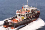
 Survey Cat (Class 3) |
| Survey Equipment | Survey Info | Data Type(s) | Data Collected |
|---|---|---|---|
| Choke Ring Antenna | --- | Benchmarks Navigation | |
| Ashtech Z-Xtreme DGPS | --- | Benchmarks Navigation | |
| Interferometric Bathymetry System | --- | Interferometric | |
| Light Detection and Ranging (LIDAR) | --- | LIDAR | |
| Applanix POS-MV DGPS/IMU | --- | Navigation | |
| Valeport SVP | --- | Sound Velocity |