Other ID: none
Status: Completed
Organization(s): USGS, St. Petersburg Coastal and Marine Science Center
Funding Program(s):
Principal Investigator(s): James Flocks, Mark Erik Hansen, Jennifer Miselis
Affiliate Investigator(s):
Information Specialist(s): Nancy DeWitt
Data Type(s): Location-Elevation: Benchmarks, Location-Elevation: Navigation, Location-Elevation: Profiles, Location-Elevation: Transects, Sonar: Interferometric, Sonar: Multibeam, Sonar: Sound Velocity
Scientific Purpose/Goals: Testing modified mount on R/V Survey Cat within designated zones for purpose of data comparison. Using the SEA SWATHplus 234-M kHz to test against the SEA SWATHplus 468-H kHz
Vehicle(s):
Start Port/Location: Saint Petersburg, FL
End Port/Location: Saint Petersburg, FL
Start Date: 2011-03-23
End Date: 2011-03-25
Equipment Used: Ashtech Z-Xtreme DGPS, Choke Ring Antenna, F190 DGPS/IMU, Interferometric Bathymetry System, Valeport SVP
Information to be Derived: Swath Bathymetry to identify differences between SEA SWATHplus -H and -M systems. Also verify repeatability of the system using OmniSTAR and Differential GPS from Ashtech GPS Receivers. Including xyz point data, xyz grid data, navigation files, and trackline images.
Summary of Activity and Data Gathered: Collected 54 raw Swath files (~5GB); 5 SVP Casts (~13KB); Base station and Boat GPS data (~104MB)
Staff: Noreen Buster, Nancy DeWitt, Kyle Kelso, Keith Ludwig, Billy Reynolds, Dana Wiese
Affiliate Staff:
Notes: Additional Equipment Used: Batteries, Laptop
This was not an actual field activity but a test of field equipment prior to deployment and data collection. The Research Topic of TST (short for Test) was assigned.
Location:
Tampa Bay, FL
| Boundaries | |||
|---|---|---|---|
| North: 28.04255783 | South: 27.58855604 | West: -82.8025 | East: -82.242206 |
Platform(s):
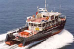 Survey Cat (Class 3) |
| Survey Equipment | Survey Info | Data Type(s) | Data Collected |
|---|---|---|---|
| Ashtech Z-Xtreme DGPS | --- | Benchmarks Navigation | |
| Choke Ring Antenna | --- | Benchmarks Navigation | No data was collected |
| F190 DGPS/IMU | --- | Navigation | |
| Interferometric Bathymetry System | --- | Interferometric | |
| Valeport SVP | --- | Sound Velocity |
