Other ID: none
Status: Completed
Organization(s): USGS, St. Petersburg Coastal and Marine Science Center
Funding Program(s): Barrier Island Evolution Research - BIER Sedimentology (GX.17.MN00.F1F50.00)
Principal Investigator(s): Hilary Stockdon
Affiliate Investigator(s):
Information Specialist(s): Billy Reynolds
Data Type(s): Environmental Data: Temperature, Imagery: Photo, Location-Elevation: Navigation, Location-Elevation: Transects, Sampling: Geology
Scientific Purpose/Goals: GPS support and ground control for lidar survey in response to Hurricane Isaac.
Vehicle(s): Ford F-350 Dually White (GSA)
Start Port/Location: Biloxi, MS
End Port/Location: Biloxi, MS
Start Date: 2012-09-04
End Date: 2012-09-14
Equipment Used: Global Positioning System (GPS), Digital Camera, GPS Topographic Survey Buggy, Sonde Multiparameter Sensor, Surface grab sampler, Choke Ring Antenna
Information to be Derived: Raw GPS data on known location for differential correction. Topographic coordinates re WGS84 for ground truthing.
Summary of Activity and Data Gathered:
Staff: Nancy DeWitt, Kyle Kelso, Billy Reynolds
Affiliate Staff:
Notes: Cores taken at this time were reassigned to FAN 12BIM05
Location:
Chandeleur Islands, LA
| Boundaries | |||
|---|---|---|---|
| North: 30.22077245 | South: 29.33360712 | West: -89.1526 | East: -88.27370043 |
Platform(s):
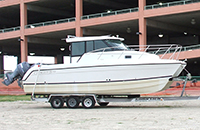 Glacier Bay Cat Boat |
Bernier, J.C., Kelso, K.W., Buster, N.A., Flocks, J.G., Miselis, J.L., DeWitt, N.T., 2014, Sediment data collected in 2012 from the northern Chandeleur Islands, Louisiana: U.S. Geological Survey Data Series 850, https://doi.org/10.3133/ds850.
Guy, K.K., Stockdon, H.F., Plant, N.G., Doran, K.S., Morgan, K.L.M., 2013, Hurricane Isaac: Observations and analysis of coastal change: U.S. Geological Survey Open-File Report 2013-1270, 21 p., https://doi.org/10.3133/ofr20131270.
| Survey Equipment | Survey Info | Data Type(s) | Data Collected |
|---|---|---|---|
| Global Positioning System (GPS) | --- | Navigation | |
| Digital Camera | --- | Photo Video | |
| GPS Topographic Survey Buggy | --- | Benchmarks Navigation Profiles Transects | |
| Sonde Multiparameter Sensor | --- | CO2 Temperature pH | |
| Surface grab sampler | --- | Biology Geology | 12LGC02_grainsize (grab samples GRADISTAT files) 12LGC02_samplesites (grab samples locations) DS_Chan2012_sediment-GIS (grab samples GIS dataset ) grainsize_summary-statistics (grab samples grain size analyses) |
| Choke Ring Antenna | --- | Benchmarks Navigation | No data was collected |
