Other ID: DSDP Leg 10; CORPUS 9
Status: Completed
Organization(s): USGS, Woods Hole Coastal and Marine Science Center
Funding Program(s):
Principal Investigator(s): Kendall Dickenson
Affiliate Investigator(s):
Information Specialist(s):
Data Type(s): Location-Elevation: Navigation, Sampling: Geology
Scientific Purpose/Goals:
Vehicle(s):
Start Port/Location: Galveston, TX
End Port/Location: Miami, FL
Start Date: 1970-02-13
End Date: 1970-04-05
Equipment Used: Grab sampler, Loran-C, Rotary core
Information to be Derived: Grain size analysis; Morphology;
Summary of Activity and Data Gathered: DSDP drill holes #85-97.
Staff:
Affiliate Staff:
J. Lamar Worzel - LDGO
Co-Chief Sci.; William Bryant - Texas A&M
Co-Chief Sci.
Notes: Project = Deep Sea Drilling Project, Deep Sea Drilling Project
Location:
Sigsbee Abyssal Plain, U.S. continental shelf, Sigsbee Scarp, Vera Cruz Gap, Campeche Scarp, Yucatan Shelf, Catoche Tongue, Gulf of America (Gulf of Mexico), United States, North America, North Atlantic;
| Boundaries | |||
|---|---|---|---|
| North: 26.15979457 | South: 20.52307375 | West: -95.99803323 | East: -83.93554688 |
Platform(s):
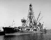 Glomar Challenger |
| Title | Survey Equipment | Description |
|---|---|---|
| Cruise Report | (document not focused on specific equipment) | Minimal information. |
| Survey Equipment | Survey Info | Data Type(s) | Data Collected |
|---|---|---|---|
| Grab sampler | --- | Biology Geology | |
| Loran-C | --- | Navigation | 1970-001-FA-LN-001 (station locations) |
| Rotary core | --- | Geology | 1970-001-FA-SC-001 (Core descriptions) |
