Other ID: LULU 31
Status: Completed
Organization(s): USGS, Woods Hole Coastal and Marine Science Center
Funding Program(s):
Principal Investigator(s): Robert N. Oldale
Affiliate Investigator(s):
Information Specialist(s):
Data Type(s): Seismics: Air Gun / Water Gun, Seismics: Boomer, Seismics: Sparker
Scientific Purpose/Goals: Test the capability of using the ship for scientific work (previously she has been used only as the tender for ALVIN); and obtain geophysical data in Nantucket and Vineyard Sounds, Buzzards Bay, and Cape Cod Bay.
Vehicle(s):
Start Port/Location: Woods Hole, MA
End Port/Location: Woods Hole, MA
Start Date: 1970-03-12
End Date: 1970-03-17
Equipment Used: Air gun, Seismic Engineering streamer
Information to be Derived: Morphology;
Summary of Activity and Data Gathered: The scientific results were good. The 10 cubic inch airgun and the time variable gain, a feature of the recorder, allowed recognition of basement in Nantucket Sound. The large airgun provided enough energy to penetrate the 100 to 300 meters of sediment and the time variable gain suppressed the multiples that usually mask the data. Throughout the cruise, detail in the upper sediments (Holocene) was sacrificed to obtain good basement reflections. Originally a 3.5 kc echo sounding system was to be used to obtain this detail, but the system and a means for towing were not available at the time of sailing. The basement morpholgy in Nantucket Sound can be recognized in the records. Several deep valleys were seen and the depth to basement appears to check reasonably with depths determined by land-based refraction data. Several horizons can be seen above the basement and in some places deep valleys are cut into the sediments. Basement was easily recognized in Buzzards Bay where it was highly irregular. Several horizons can be recognized in the overlying sediments where basement is deep. The records from Cape Cod Bay showed flat-lying sediments over an irregular basement. Several valleys were seen cut into the basement and in the sediments.
Staff: Robert N. Oldale
Affiliate Staff:
WHOI Ocean Engineering: George Meir
Clifford Winget; WHOI student: Dan Jipa
Notes: Two major problems developed in the profiling system during the cruise. The coupling between the high stage compressor and high stage pressure tank failed three times. The first two times, during the survey of Cape Cod Bay, required considerable time to repair. The third failure occurred just as the cruise was completed. The failures indicate that a flexible coupling is necessary between the compressor and tank. The other failure of the system also occurred in Cape Cod Bay when the airgun broke loose from the fish. This was easily repaired and the airgun gave no further trouble; however, a stronger mount between the airgun and the fish should be devised. Breaking of the seal retainer springs in the airgun, caused by a high repetition rate (2 to 4 sec.) that occurred on the fall cruise to the western Gulf of Maine did not occur on this cruise.
Location:
Nantucket Sound, Vineyard Sound, Buzzards Bay, Cape Cod Bay, Massachusetts, United States, North America, North Atlantic;
| Boundaries | |||
|---|---|---|---|
| North: 42.5 | South: 41.5 | West: -71 | East: -70 |
Platform(s):
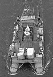 Lulu |
| Title | Survey Equipment | Description |
|---|---|---|
| Cruise Report | (document not focused on specific equipment) | USGS Scientist's report with location, personnel, dates, and narrative. |
| Survey Equipment | Survey Info | Data Type(s) | Data Collected |
|---|---|---|---|
| Air gun | --- | Air Gun / Water Gun | |
| Seismic Engineering streamer | --- | Air Gun / Water Gun Boomer Sparker |
