Other ID: CORPUS 11
Status: Completed
Organization(s): USGS, Woods Hole Coastal and Marine Science Center
Funding Program(s):
Principal Investigator(s): Louis E. Garrison
Affiliate Investigator(s):
Information Specialist(s): Louis E. Garrison
Data Type(s): Location-Elevation: Navigation, Seismics: Sparker
Scientific Purpose/Goals: High-resolution seismic survey.
Vehicle(s):
Start Port/Location: San Juan, Puerto Rico
End Port/Location: St. Thomas, U.S. Virgin Islands
Start Date: 1970-04-09
End Date: 1970-04-14
Equipment Used: Sparker , Visual navigation, Single channel hydrophone
Information to be Derived: Morphology;
Summary of Activity and Data Gathered: Sparker; High-resolution continuous seismic reflection profiles: 277 km.
Staff:
Affiliate Staff:
Notes: Project = Tektite II - Virgin Islands Co-op, Tektite II - Virgin Islands Co-op
Location:
Virgin Islands platform, U.S. Virgin Islands, United States, northeast Caribbean, North America, North Atlantic;
| Boundaries | |||
|---|---|---|---|
| North: 18.3 | South: 18.2 | West: -65.01 | East: -64.7 |
Platform(s):
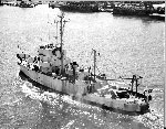 Advance II |
Garrison, L.E., Holmes, C.W., and Trumbull, J.V.A., 1971, Geology of the insular shelf south of St. Thomas and St. John, U.S. Virgin Islands: U.S. Geological Survey Open-file Report 71-117, 38 p., URL: https://doi.org/10.3133/ofr71117.
| Title | Survey Equipment | Description |
|---|---|---|
| Cruise report | (document not focused on specific equipment) | Minimal information. |
| Seismic log | Sparker | Equipment description, daily log, and line start and end times. The scanned logbook cover also refers to 1 other field activity - 1970-003-FA, but the contents of the PDF are specific to this cruise. |
| Survey Equipment | Survey Info | Data Type(s) | Data Collected |
|---|---|---|---|
| Sparker | --- | Sparker | |
| Visual navigation | --- | Navigation | |
| Single channel hydrophone | --- | Air Gun / Water Gun Boomer Bubble Gun Sparker Sub Bottom Profiler |
