Other ID: HUNT Cruise I; Leg I
Status: Completed
Organization(s): USGS, Woods Hole Coastal and Marine Science Center
Funding Program(s):
Principal Investigator(s): Robert N. Oldale
Affiliate Investigator(s):
Information Specialist(s):
Data Type(s): Electro-Magnetic: Magnetics, Location-Elevation: Navigation, Seismics: Boomer, Seismics: Sonobuoy, Sonar: Sidescan
Scientific Purpose/Goals: Cruise was first part of the search for drilling sites along the north flank of Georges Bank.
Vehicle(s):
Start Port/Location:
End Port/Location:
Start Date: 1972-07-21
End Date: 1972-08-02
Equipment Used: Boomer, Seismic refraction, Marine magnetometer, Loran-C, Single channel hydrophone, EG&G Mark 1A sidescan sonar
Information to be Derived:
Summary of Activity and Data Gathered:
Staff: Raymond E. Hall, John Hendricks, Frank W. Jennings, Charles J. O'Hara, Robert N. Oldale
Affiliate Staff:
Phil Clark
David Davis
Gary Stuckey
Robert White
Notes:
Location:
Georges Bank, United States, North America, North Atlantic,
| Boundaries | |||
|---|---|---|---|
| North: 42.5 | South: 39.9 | West: -70 | East: -65 |
Platform(s):
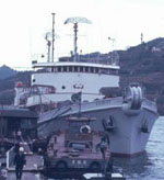 Hunt |
Oldale, R.N., Hathaway, J.C., Dillon, W.P., Hendricks, J.D., and Robb, J.M., 1974, Geophysical observations on northern part of Georges Bank and adjacent basins of Gulf of Maine: The American Association of Petroleum Geologists Bulletin, AAPG Bulletin, v. 58 no. 12, URL: https://pubs.er.usgs.gov/publication/70121288.
Schlee, J., Mattick, R.E., Taylor, D.J., Girard, O.W., Grow, J., Rhodehamel, E.C., Perry, W.J., Jr., Bayer, K.C., Furbush, M., Clifford, C.P., and Lees, J.A., 1975, Sediments, structural framework, petroleum potential, environmental conditions, and operational considerations of the United States North Atlantic Outer Continental Shelf: U.S. Geological Survey Open-File Report 75-353, https://doi.org/10.3133/ofr75353.
| Title | Survey Equipment | Description |
|---|---|---|
| Cruise report | (document not focused on specific equipment) | Chief Scientist's summary describing personnel, data type, dates of field work, and track map. |
| Cruise log | (document not focused on specific equipment) | Field log containing Loran-C navigation positions, sonobouy, gravity meter, magnetometer, CSP airgun, and 3.5 kHz Uniboom data acquisition notes. |
| Survey Equipment | Survey Info | Data Type(s) | Data Collected |
|---|---|---|---|
| Boomer | --- | Boomer | |
| Seismic refraction | --- | Sonobuoy | |
| Marine magnetometer | --- | Magnetics | |
| Loran-C | --- | Navigation | 1972-003-FA-LN-002 (Digital tape(s) of NV-FINAL, ) 1972-003-FA-NL-001-02 (Field log containing Loran-C navigation positions, sonobuoy, gravity meter, magnetometer, CSP airgun, and 3.5 kHz Uniboom data acquisition notes. ) |
| Single channel hydrophone | --- | Air Gun / Water Gun Boomer Bubble Gun Sparker Sub Bottom Profiler | 1972-003-FA-SE-002 (analog tape of seismic data) 1972-003-FA-SE-001 (microfilm of ) |
| EG&G Mark 1A sidescan sonar | --- | Sidescan | 1972-003-FA-SO-001 ( Collection of paper record displays of sidescan sonar data for lines ) |
