Other ID: none
Status: Completed
Organization(s): USGS, Woods Hole Coastal and Marine Science Center
Funding Program(s):
Principal Investigator(s): Harley J. Knebel
Affiliate Investigator(s):
Information Specialist(s):
Data Type(s): Environmental Data: Temperature, Imagery: Photo, Location-Elevation: Navigation, Sampling: Chemistry, Seismics: Boomer, Seismics: Sub Bottom Profiler, Sonar: Single Beam
Scientific Purpose/Goals: Commence studies of the movement and characteristics of bottom sediments and of the abundance and distribution of benthic organisms via acoustic survey and bottom sampling.
Vehicle(s):
Start Port/Location: Norfolk, VA
End Port/Location: Norfolk, VA
Start Date: 1974-05-15
End Date: 1974-05-30
Equipment Used: Ross Model 5000 fathometer, 3.5 kHz, Boomer, Nansen bottles, 35 mm camera, Loran-C, Single channel hydrophone
Information to be Derived:
Summary of Activity and Data Gathered: Tracklines: 2,348 km; Fathometer: 2,144 km; 3.5 kHz records: 1,809 km; EG&G Uniboom: 1,787 km; Sample stations: 93; Bottom sediment grabs: 228; Bottom water samples: 36.
Staff: Robert F. Commeau, Patricia Forrestel, Frank W. Jennings, Harley J. Knebel, Charles Meeder, Charles J. O'Hara, Barbara Tausey
Affiliate Staff:
David Radosh - NMFS-Sandy Hook
NJ; Karen O'Donnell - NOAA Corps; Robert Pawlowski - Ensign
NOAA Corps; Thomas J. McConnell - MT. MITCHELL Chief Survey Tech.; Frank Lamison - NOAA survey technician; Everett Marsh - NOAA survey technician; Paul Spithailer - NOAA survey technician; David Barnes - University of Western Michigan
Notes:
Location:
Baltimore Canyon Trough, outer continental shelf, offshore New Jersey, Delaware, Maryland, United States, North America, North Atlantic;
| Boundaries | |||
|---|---|---|---|
| North: 39.64893676 | South: 36.78191456 | West: -76.61502564 | East: -72.27179999 |
Platform(s):
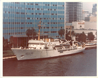
 Mt Mitchell |
Foster, D.S., Brothers, L.L., Baldwin, W.E., and Pendleton, E.A., 2023, Geospatial data layers of shallow geology from the inner continental shelf of the Delmarva Peninsula, including Maryland and Virginia state waters: U.S. Geological Survey data release, https://doi.org/10.5066/P9GQY0ZN.
Knebel, H.J., and Twichell, D.C., 1978, Heavy-mineral variability in the Baltimore Canyon trough area: Journal of Research of the U.S. Geological Survey, vol. 6, issue 2, https://pubs.er.usgs.gov/publication/70232935.
Sheridan, R.E., and Knebel, H. J., 1976, Evidence of post-Pleistocene faults on New Jersey Atlantic outer continental shelf: The American Association of Petroleum Geologists Bulletin, AAPG Bulletin, v. 60 no. 7, URL: http://aapgbull.geoscienceworld.org/cgi/content/abstract/60/7/1112.
| Title | Survey Equipment | Description |
|---|---|---|
| Cruise report | (document not focused on specific equipment) | Chief Scientist cruise report of data acquisition, equipment notes, etc. Includes amount of information gathered. |
| Survey Equipment | Survey Info | Data Type(s) | Data Collected |
|---|---|---|---|
| Ross Model 5000 fathometer | --- | Single Beam | |
| 3.5 kHz | --- | Sub Bottom Profiler | |
| Boomer | --- | Boomer | |
| Nansen bottles | --- | Temperature Chemistry | |
| 35 mm camera | --- | Photo | 1974-004-FA-PH-001 (Ship photo) |
| Loran-C | --- | Navigation | 1974-004-FA-LN-002-03 (Track Chart, Subarea III (pdf file) Track chart with dates and 15 minute fixes.) 1974-004-FA-LN-001 (microfilm of LINES 1-109) 1974-004-FA-LN-003 (Digital tape(s) of NV-LORAN C, NV-SUBAREAS, TRKCHT, NV-FINAL, SEIS LINES ONLY, ) 1974-004-FA-LN-002-02 (Track Chart, Subarea II (pdf file) Track chart with dates and 15 minute fixes.) 1974-004-FA-NL-001-01 (Chief Scientist's cruise report of data acquisition, equipment notes, etc.) |
| Single channel hydrophone | --- | Air Gun / Water Gun Boomer Bubble Gun Sparker Sub Bottom Profiler | 1974-004-FA-SE-001 (film collection of ) 1974-004-FA-SE-002 ( Collection of paper record displays of seismic data( 3.5K) for lines ) 1974-004-FA-SE-003 (microfilm of LINES 1-109) |