Other ID: KNKE BLM-Leg Alpha; CORPUS 22/28
Status: Completed
Organization(s): USGS, Woods Hole Coastal and Marine Science Center
Funding Program(s):
Principal Investigator(s): Charles W. Holmes
Affiliate Investigator(s):
Information Specialist(s):
Data Type(s): Sampling: Biology, Sampling: Geology, Biological Field Study: Experiments (biological), Environmental Data: Temperature, Imagery: Photo, Environmental Data: Current
Scientific Purpose/Goals: The program is designed to establish chemical, biological, and geological baseline on the South Texas Continental Shelf. The focus for the geological program is to establish the nature and amount of the suspended sediment in the water column, to establish the nature and amount of the Holocene sediments on the shelf, and to identify and locate regions of geologic conditions which may be hazardous to OCS operations. Three cruises are planned. The first two cruises are designated as sampling cruises in which grab samples, box cores, and pipe cores will be taken at sites previously designated.
Vehicle(s):
Start Port/Location:
End Port/Location:
Start Date: 1974-10-27
End Date: 1974-11-08
Equipment Used: Smith-MacIntyre grab, Box corer, XBT, Camera- deep sea, Current Drift Bottle, Piston corer
Information to be Derived:
Summary of Activity and Data Gathered: 3.5 kHz seismic reflection profiles suggest numerous gas seeps associated with down-to-the-basin faulting along the outer edge of the shelf. Numerous manganese nodules of pebble size were obtained from a topographic high near the outer edge of the shelf in an area of a known high rate of sediment deposition. This is the first report of manganese nodules in the western Gulf. The XBT data showed a mass of warm water over the middle and outer shelf that seems to have become detached from the coast; over the northern part of the survey area the warm water mass was present at the surface, but southward the warm water layer was overlain to progressively greater depths by colder surface water. This is an anomalous and unexpected circumstance that probably reflects a complex water movement pattern on this shelf that is related to an interaction of shelf circulation and wind surface stress. Smith-MacIntyre grabs: 151 (6 subsamples per station); Piston cores: 49 (3-10 feet); Box cores: 5; XBT casts: 67; Bottom photographs: 37; Suspended sediments: 24 (3 at each of 8 stations); Benthic infauna: 156; Drift bottle casts: 43 stations.
Staff: Charles W. Holmes, Ronald J. Miller, Michael Dorsey, Marty Detwiler, Robert Atkins, Don Fiedler, Stanley Lindquist, Roger Stovall
Affiliate Staff:
Michael English (Navigator - Decca)
Roger Melton (Navigator - Decca); Gerald Pfeiffer (Biologist - University of Texas)
Notes: Project = Marine geological survey of the South Texas OCS, Marine geological survey of the South Texas OCS
Information from Foghorn: Smith-MacIntyre grab;Piston corer;Box corer;XBTs;Bottom camera;Drift bottles;
Location:
south Texas continental shelf, Texas, United States, Gulf of America (Gulf of Mexico), North America, North Atlantic;
| Boundaries | |||
|---|---|---|---|
| North: 28.5 | South: 26 | West: -97.4 | East: -95.95 |
Platform(s):
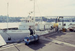 Kana Keoki |
Flores, R.M., and Shideler, G. L., 1978, Factors controlling heavy-mineral variations on the South Texas outer continental shelf, Gulf of Mexico: Journal of Sedimentary Research, v. 48 no. 1, URL: http://jsedres.sepmonline.org/cgi/reprint/48/1/269.
Shideler, G.L., 1988, Heavy-mineral placer potential map of the U.S. continental shelf, western and northern Gulf of Mexico: U.S. Geological Survey Miscellaneous Field Studies Map 2037, 1 sheet, URL: https://pubs.er.usgs.gov/publication/mf2037.
Shideler, G.L., and Flores, Romeo M., 1976, Maps showing distribution of heavy minerals on the south Texas outer continental shelf: U.S. Geological Survey Miscellaneous Field Studies Map 841, 1 sheet, URL: https://pubs.er.usgs.gov/publication/mf841.
| Title | Survey Equipment | Description |
|---|---|---|
| Cruise report | (document not focused on specific equipment) | Chief Scientist's cruise report describing ship movement, personnel, equipment and data acquisition notes, area map with sample locations marked. |
| Survey Equipment | Survey Info | Data Type(s) | Data Collected |
|---|---|---|---|
| Smith-MacIntyre grab | --- | Biology Geology | |
| Box corer | --- | Biology Geology | |
| XBT | --- | Temperature | |
| Camera- deep sea | --- | Photo | |
| Current Drift Bottle | --- | Current | |
| Piston corer | --- | Geology |
