Other ID: KNKE BLM-Leg Charlie; CORPUS 24/30
Status: Completed
Organization(s): USGS, Woods Hole Coastal and Marine Science Center
Funding Program(s):
Principal Investigator(s): Henry Berryhill
Affiliate Investigator(s):
Information Specialist(s):
Data Type(s): Environmental Data: Conductivity, Environmental Data: Temperature, Location-Elevation: Navigation, Sampling: Chemistry, Seismics: Sparker, Sonar: Sidescan, Sonar: Single Beam
Scientific Purpose/Goals: The overall program is a baseline assessment of the South Texas Outer Continental Shelf. Objectives of the geological studies being carried out under the program by the USGS are: nature and distribution of bottom sediments, nature of suspended sediments in the water column, trace metals chemistry of sediments; late Pleistocene and Holocene structural and sedimentologic evolution of the shelf; delineation of surface areas of the shelf where geologic conditions might be hazardous to petroleum development; and predictive evaluation to the extent possible of the possible effects of the physical and chemical processes operative across the shelf on the dispersion and assimilation of contaminants that might be generated by petroleum development.
Vehicle(s):
Start Port/Location:
End Port/Location:
Start Date: 1974-11-29
End Date: 1974-12-21
Equipment Used: Klein 400 sidescan sonar, Sparker , Magnavox satellite positioning system, XBT, Loran-A, Niskin bottle, Single channel hydrophone, 12 kHz
Information to be Derived:
Summary of Activity and Data Gathered: Patterns on the acoustic profiles that are believed to be gas seeps were recorded at a number of places on the shelf (most numerous on the outer edge of the shelf). Extensive faulting exists over most parts of the South Texas OCS. The submerged reefs, or so-called topographic highs, are but the exposed part of extensive thin carbonate banks buried by sedimentation. Smith-MacIntyre grabs: 40; Gravity cores: 13; Box cores: 32; Benthic faunal collections: 72; XBTs: 12; Surface drifter casts: 36 (3 at each of 12 stations); Quality control sample for trace metals: 6; Hydrocarbon back-up sample: 32; Water samples for suspended sediments: 9 (3 at each of 3 stations); Minisparker: 1,000 mi.; 3.5 kHz profiles: 1,400 miles; 12 kHz PDR; Klein Model 400 sidescan sonar: approx. 400 miles.
Staff: Henry Berryhill, Robert Fitchko, Patricia Forrestel, Jean Freeland, Elizabeth Hovey, Deborah Hutchinson, Charles Meeder, Ronald J. Miller, Richard Phillips
Affiliate Staff:
Donald McNair (ET
sidescan sonar - Ocean Systems
Inc.); Robert Cole (Regional Supervisor - Decca Co.); Robert Trice (Navigator - Decca Co.); Roger Melton (Navigator - Decca Co.)
Notes: Project = Marine geological survey of the South Texas OCS, Marine geological survey of the South Texas OCS
Location:
south Texas outer continental shelf, Texas, United States, Gulf of America (Gulf of Mexico), North America, North Atlantic;
| Boundaries | |||
|---|---|---|---|
| North: 28.5 | South: 26 | West: -97.25 | East: -95.8 |
Platform(s):
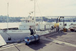 Kana Keoki |
Flores, R.M., and Shideler, G. L., 1978, Factors controlling heavy-mineral variations on the South Texas outer continental shelf, Gulf of Mexico: Journal of Sedimentary Research, v. 48 no. 1, URL: http://jsedres.sepmonline.org/cgi/reprint/48/1/269.
Shideler, G.L., 1988, Heavy-mineral placer potential map of the U.S. continental shelf, western and northern Gulf of Mexico: U.S. Geological Survey Miscellaneous Field Studies Map 2037, 1 sheet, URL: https://pubs.er.usgs.gov/publication/mf2037.
Shideler, G.L., and Flores, Romeo M., 1976, Maps showing distribution of heavy minerals on the south Texas outer continental shelf: U.S. Geological Survey Miscellaneous Field Studies Map 841, 1 sheet, URL: https://pubs.er.usgs.gov/publication/mf841.
| Title | Survey Equipment | Description |
|---|---|---|
| Cruise report | (document not focused on specific equipment) | Chief Scientist's cruise report describing ship movement, personnel, equipment and data acquisition notes, area map (one with tracklines and one with sample locations). |
| Survey Equipment | Survey Info | Data Type(s) | Data Collected |
|---|---|---|---|
| Klein 400 sidescan sonar | --- | Sidescan | |
| Sparker | --- | Sparker | |
| Magnavox satellite positioning system | --- | Navigation | |
| XBT | --- | Temperature | |
| Loran-A | --- | Navigation | |
| Niskin bottle | --- | Chemistry | |
| Single channel hydrophone | --- | Air Gun / Water Gun Boomer Bubble Gun Sparker Sub Bottom Profiler | |
| 12 kHz | --- | Single Beam |
