Other ID: FLOR FC A, Legs 1 and 2; FLOR FC B
Status: Completed
Organization(s): USGS, Woods Hole Coastal and Marine Science Center
Funding Program(s):
Principal Investigator(s): William Dillon
Affiliate Investigator(s): Jean-Pierre Fail, Institut Francais du Petrole (IFP)
Information Specialist(s): Nancy K. Soderberg
Data Type(s): Electro-Magnetic: Gravity, Electro-Magnetic: Magnetics, Imagery: Photo, Location-Elevation: Navigation, Seismics: Multichannel, Sonar: Single Beam
Scientific Purpose/Goals: This cruise was carried out as part of a cooperative study by the USGS and the Institute Francais du Petrole (IFP) to collect DEP seismic profiles, gravity, magnetics, and refraction profiling data on the Blake Plateau, Southeast Georgia Embayment.
Vehicle(s):
Start Port/Location: Miami, FL
End Port/Location: Miami, FL
Start Date: 1975-01-07
End Date: 1975-04-26
Equipment Used: Gravity meter (wh), Marine magnetometer, Loran-C, 35 mm camera, Multichannel seismics, 12 kHz
Information to be Derived:
Summary of Activity and Data Gathered: CDP multichannel seismic data: 10 lines (FC-1 thru FC-10).
Staff: Kenneth Bayer, William Dillon, Perry Parks
Affiliate Staff:
Robert Goldsborough - WHOI (Jan. 7-21
1975); Constantine Tollios - WHOI (Jan. 7-13
1975); Various IFP personnel (entire cruise)
Notes: USGS personnel participated in FC A Legs 1 (7-13 Jan. 1975) and 2 (15-21 Jan. 1975). Because the cruise was ended due to the breakdown of equipment, the IFP agreed to carry out further profiling in mid-April. Lines FC-8, FC-9 and FC-10 and a repeat of Line FC-3 were collected April 17-25, 1975, by the IFP aboard the FLORENCE. Original Center People field contained: Bill Dillon - Ch. Sci. (Jan. 7-21, 1975); Perry Parks (Jan. 7-21, 1975); Kenneth Bayer (Jan. 15-21, 1975).
Project = French Connection, French Connection
Location:
Blake Plateau, Southeast Georgia Embayment, United States, North America, North Atlantic;
| Boundaries | |||
|---|---|---|---|
| North: 33.11097122 | South: 26.8 | West: -80.72753906 | East: -75.5 |
Platform(s):
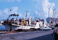
 Florence |
Dillon, W.P., Paull, C.K., Buffler, R.T., and Fail, J.-P., 1979, Structure and development of the Southeast Georgia Embayment and northern Blake Plateau; preliminary analysis; in Watkins, J.S., Montadert, L., and Dickerson, P.W., eds., Geological and geophysical investigations of continental margins: American Association of Petroleum Geologists (AAPG) Memoir 29, , URL: https://pubs.er.usgs.gov/publication/70137307.
Hutchinson, D.R., Poag, C.W., Johnson, A.H., Popenoe, P. and Wright, C., 1997, Geophysical database of the east coast of the United States; southern Atlantic margin, stratigraphy and velocity in map grids: U.S. Geological Survey Open-File Report 96-55, https://doi.org/10.3133/ofr9655.
Hutchinson, D.R., Poag, C.W., and Popenoe, P., 1995, Geophysical database of the east coast of the United States; southern Atlantic margin, stratigraphy and velocity from multichannel seismic profiles: U.S. Geological Survey Open-File Report 95-27, https://doi.org/10.3133/ofr9527.
| Title | Survey Equipment | Description |
|---|---|---|
| Cruise report | (document not focused on specific equipment) | Chief Scientist's cruise report. Includes crude track map. |
| Contractor's processing report. | (document not focused on specific equipment) | The digital processing services and interpretation report from the contractor. In French and English. Includes a simple track map. |
| Contractor's cruise report | (document not focused on specific equipment) | Document in French. Appears to be a cruise report of shipboard acquisition and possibly simple processing. |
| Observer log | Multichannel seismics | Observer logs for 10 lines. The log sheets are in French (headings of information). There are 10 separate PDF files. |
| Tape Processing Records | Multichannel seismics | Appear to be records documenting the reading of the 9-track tapes. 14 individual PDF files with minimal information. |
| Survey Equipment | Survey Info | Data Type(s) | Data Collected |
|---|---|---|---|
| Gravity meter (wh) | --- | Gravity | 1975-001-FA-GP-001-02 (Gravity and Magnetic data recovered fom 9 track tapes) |
| Marine magnetometer | --- | Magnetics | 1975-001-FA-GP-001-01 (Gravity and Magnetic data recovered fom 9 track tapes) |
| Loran-C | --- | Navigation | 1975-001-FA-LN-002-02 (Raw Shotpoint navigation for all lines
) 1975-001-FA-LN-002-01 (Processed Shotpoint navigation for all lines ) 1975-001-FA-LN-001-01 (Contracted Atlantic Marine Multi-channel Seismic Reflection Tracklines (pdf file) Generalized track map depicting tracklines for several data sets including lines FC1 through FC10 collected by the Institut Francais du Petrole aboard the FLORENCE.) |
| 35 mm camera | --- | Photo | 1975-001-FA-PH-001 (Cruise Photos) |
| Multichannel seismics | --- | Multichannel | 1975-001-FA-SE-001-01 (Paper record section of Lines FC-10, FC-08, FC-01, FC-02, FC-03, FC-04, FC-05, FC-06, FC-07, FC-08A, FC-09, FC-01C, ) 1975-001-FA-SE-003 (analog tape of seismic data) 1975-001-FA-SE-001-02 (CD ROM disk of FC01-1 NO STACK, FC01-2 NO STACK, FC01-3 NO STACK, FC01-4 NO STACK, FC01-5 NO STACK, FC01-6 NO STACK, FC02-1 NO STACK,NO NAV,, FC03-1 NO STACK, FC03-2 NO STACK, FC03-3 NO STACK, FC03-4 NO STACK, FC03-5 NO STACK, FC03-6 NO STACK, FC03-7 NO STACK, FC03-8 NO STACK, FC04-1 NO STACK, FC05-1 NO STACK, FC05-2 NO STACK, FC06-1 NO STACK, FC06-2 NO STACK, FC07-1 NO STACK, FC07-2 NO STACK, FC07-3 NO STACK, FC07-4 NO STACK, FC08-1 NO STACK, FC08-2 NO STACK, FC08AP13-3 NO STACK, FC08AP12-4 NO STACK, FC08AP13-5 NO STACK, FC09-1 NO STACK, FC09-2 NO STACK, FC10-1 NO STACK, FC10-2 NO STACK, FC10-3 NO STACK, FC10-4 NO STACK, FC10-5 NO STACK, FC10-6 NO STACK, NAVOCEANO ATLANTIC PLOTS, ) 1975-001-FA-SE-001-08 (Line FC-6 * DEMUX SEG-Y Data) 1975-001-FA-SE-001-04 (Line FC-2 * DEMUX SEG-Y Data -) 1975-001-FA-SE-001-11 (Line FC-9 * DEMUX SEG-Y Data ) 1975-001-FA-SE-001-09 (Line FC-7 * DEMUX SEG-Y Ddata) 1975-001-FA-SE-001-07 (Line FC-5 * DEMUX SEG-Y Data) 1975-001-FA-SE-001-06 (Line FC-4 * DEMUX SEG-Y Data) 1975-001-FA-SE-002 (microfilm of NOT IN JOHN PORTEUS' FILE??) 1975-001-FA-SE-001-10 (Line FC-8 * DEMUX SEG-Y Data) 1975-001-FA-SE-001-12 (Line FC-10 * DEMUX SEG-Y Data) 1975-001-FA-SE-001-05 (Line FC-3 * DEMUX SEG-Y Data ) 1975-001-FA-SE-001-03 (Line FC-1 * DEMUX SEG-Y Data) |
| 12 kHz | --- | Single Beam | 1975-001-FA-BA-001 (Digital tape(s) of NV-FINAL, GR OR MG?, NV-CDP LINES, BT, NV-SP 4 FILES, NV-SAT-LORAN, NV-SAT ONLY, MG,GR, GR-FINAL, NV-SP 14 FILES, NV-SP 8 FILES, BT-FINAL, ) |