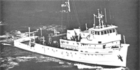
Other ID: FAY 002
Status: Completed
Organization(s): USGS, Woods Hole Coastal and Marine Science Center
Funding Program(s):
Principal Investigator(s): Richard Wold
Affiliate Investigator(s):
Information Specialist(s):
Data Type(s): Electro-Magnetic: Gravity, Electro-Magnetic: Magnetics, Location-Elevation: Navigation, Seismics: Air Gun / Water Gun, Seismics: Sub Bottom Profiler, Seismics: Sparker
Scientific Purpose/Goals: The overall objective of this cruise was to check the operation of all the geophysical systems. Each system was to be checked out and modified where necessary until the best possible data were obtained. The acoustic characteristics of the vessel were to be checked by towing the various sensors at different speeds. When all of the systems were operating properly, data was to be obtained as part of the geophysics profiling program on Georges Bank.
Vehicle(s):
Start Port/Location: Woods Hole, MA
End Port/Location: Woods Hole, MA
Start Date: 1975-09-27
End Date: 1975-09-29
Equipment Used: Marine magnetometer, Sparker , Gravity meter (wh), Single channel hydrophone, 3.5 kHz, Loran-C, Air gun
Information to be Derived:
Summary of Activity and Data Gathered: All geophysical systems were tested and problems identified, and 440 km of usable gravity data were obtained.
Staff: Thomas Aldrich, Dennis Edwards, John Grow, William Jaworski, Frank W. Jennings, Perry Parks, John S. Schlee, Richard E. Sylwester, Richard Wold
Affiliate Staff:
Joseph Burden (Raytheon); Frank Wood (SEI); Jack Mago (Geometrics); Donald Price (Price Compressor Co.)
Notes: Original Center People field contained: Richard Wold, John Schlee, John Grow, Thomas Aldrich, Bill L. Jaworski, Frank Jennings, Perry Parks, Richard Sylwester, Dennis Edwards, Michael Kerkmann, Felicity Oram.
Location:
Middle Atlantic Bight, United States, North America, North Atlantic;
| Boundaries | |||
|---|---|---|---|
| North: 41.5 | South: 39.60850873 | West: -71.5 | East: -69.607953 |
Platform(s):
 Fay |
Paskevich, V.F., and Soderberg, N.K., 1997, Navigation and geophysical data collected onboard the R/V Fay from 1975-1976: U.S. Geological Survey Open-File Report 97-512, CD-ROM, URL: https://doi.org/10.3133/ofr97512.
| Title | Survey Equipment | Description |
|---|---|---|
| Cruise report | (document not focused on specific equipment) | Chief Scientist's cruise report describing ship movement, personnel, equipment and data acquisition notes and track map. |
| Survey Equipment | Survey Info | Data Type(s) | Data Collected |
|---|---|---|---|
| Marine magnetometer | --- | Magnetics | |
| Sparker | --- | Sparker | |
| Gravity meter (wh) | --- | Gravity | |
| Single channel hydrophone | Test of equipment only | Air Gun / Water Gun Boomer Bubble Gun Sparker Sub Bottom Profiler | No data was collected |
| 3.5 kHz | Test of equipment only | Sub Bottom Profiler | No data was collected |
| Loran-C | --- | Navigation | 1975-021-FA-LN-002 (Navigation data) |
| Air gun | --- | Air Gun / Water Gun |