Other ID: FAY 003
Status: Completed
Organization(s): USGS, Woods Hole Coastal and Marine Science Center
Funding Program(s):
Principal Investigator(s): John S. Schlee
Affiliate Investigator(s):
Information Specialist(s): Nancy K. Soderberg
Data Type(s): Electro-Magnetic: Gravity, Electro-Magnetic: Magnetics, Location-Elevation: Navigation, Seismics: Air Gun / Water Gun, Seismics: Sparker, Seismics: Sub Bottom Profiler
Scientific Purpose/Goals: The main purposes of the cruise were to (1) investigate the shallow structure of the area (as a key to spot potential geologic hazards), (2) to conduct a study of the deeper crustal structure through measurement of gravity and magnetics and through seismic reflection profiles, and (3) to collect shallow seismic reflection profiles over areas where vibracores were taken on the first cruise of the FAY.
Vehicle(s):
Start Port/Location: Woods Hole, MA
End Port/Location: Woods Hole, MA
Start Date: 1975-10-02
End Date: 1975-10-17
Equipment Used: 3.5 kHz, Sparker , Air gun, Marine magnetometer, Gravity meter (wh), Internav 101 LORAN-C, Single channel hydrophone
Information to be Derived: Bathymetric maps;
Summary of Activity and Data Gathered: The cruise completed a survey with a 20 km line spacing (N-S) over the bank with 3 tie lines along the central northern and southern parts of the bank. Lines were extended into the deep ocean (1800 m) to assure coverage over the continental slope. 3.5 kHz: 3486 km (1882 nm); Minisparker: 3187 km (1721 nm); Airgun: 3608 km (1948 nm); Gravity: 3897+ km (2104 nm); Magnetics (gradiometer): 3700 km (1998 nm).
Staff: Dennis Edwards, Frank W. Jennings, Perry Parks, John S. Schlee, Richard E. Sylwester, Stanley Locker
Affiliate Staff:
John Lero (First Mate)
Jim Biller (Third Mate)
Lyle McGinnis (University of N. Illinois)
Notes: Original Center People field contained: John Schlee, Paul Cousins, Ellen Davie, Dennis Edwards, Peter Gleba, Prescott Heald, Frank Jennings, Mike Kerkmann, Stanley Locker, Felicity Oram, Perry Parks, Douglas Peeler, Fran Scarver, Dick Sylwester.
Location:
Georges Bank, Nantucket Shoals, Massachusetts, United States, North America, North Atlantic;
| Boundaries | |||
|---|---|---|---|
| North: 42.32154906 | South: 39.97244204 | West: -71.3708142 | East: -65.59936523 |
Platform(s):
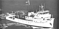
 Fay |
Chaytor, J.D., ten Brink, Uri S., Solow, Andrew R., and Andrews, Brian D., 2009, Size distribution of submarine landslides along the U.S. Atlantic margin: Marine Geology, v. 264 no. 1-2, doi: 10.1016/j.margeo.2008.08.007.
Geist, E.L., Lynett, Patrick J., and Chaytor, Jason D., 2009, Hydrodynamic modeling of tsunamis from the Currituck landslide: Marine Geology, v. 264 no. 1-2, doi: 10.1016/j.margeo.2008.09.005.
O'Leary, D.W., 1986, Seismic structure and stratigraphy of the New England continental slope and the evidence for slope instability: U.S. Geological Survey Open-File Report 86-118, https://doi.org/10.3133/ofr86118.
Paskevich, V.F., and Soderberg, N.K., 1997, Navigation and geophysical data collected onboard the R/V Fay from 1975-1976: U.S. Geological Survey Open-File Report 97-512, CD-ROM, URL: https://doi.org/10.3133/ofr97512.
ten Brink, U.S., Barkan, R., Andrews, B.D., and Chaytor, J.D., 2009, Size distributions and failure initiation of submarine and subaerial landslides: Earth and Planetary Science Letters, v. 287 no. 1-2, doi: 10.1016/j.epsl.2009.07.031.
Twichell, D.C., Chaytor, Jason D., ten Brink, Uri S., and Buczkowski, Brian, 2009, Morphology of late Quaternary submarine landslides along the U.S. Atlantic continental margin: Marine Geology, v. 264 no. 1-2, doi: 10.1016/j.margeo.2009.01.009.
| Title | Survey Equipment | Description |
|---|---|---|
| Cruise report | (document not focused on specific equipment) | Chief Scientist's cruise report describing ship movement, personnel, equipment and data acquisition notes. Individual track maps of data acquisition for each geophysical system on the cruise. |
| Survey Equipment | Survey Info | Data Type(s) | Data Collected |
|---|---|---|---|
| 3.5 kHz | --- | Sub Bottom Profiler | 1975-022-FA-SE-001 ( Collection of paper record displays of seismic data( 3.5K) for lines ) |
| Sparker | --- | Sparker | |
| Air gun | --- | Air Gun / Water Gun | |
| Marine magnetometer | --- | Magnetics | |
| Gravity meter (wh) | --- | Gravity | 1975-022-FA-GP-001 (Digital tape(s) of GR, ) |
| Internav 101 LORAN-C | --- | Navigation | 1975-022-FA-LN-002 (Navigation File (txt file) Navigation file with latitude and longitude; no time.) 1975-022-FA-LN-001-02 (Track Map (pdf file) Plotted track map with dates and times.) 1975-022-FA-LN-001-01 (Track Map (pdf file) Plotted track map with line numbers, dates and times.) |
| Single channel hydrophone | --- | Air Gun / Water Gun Boomer Bubble Gun Sparker Sub Bottom Profiler | 1975-022-FA-SE-002 (microfilm of ) 1975-022-FA-SE-003 (analog tape of seismic data) |